We recently got remarried, and made the choice to go on a road trip. I hate what is going on in this country under Trump, so we thought a road trip into nature would be worthwhile. We had an ambitious agenda all in all covering 3150 miles and 8 states.

I’ll say this as a precis: Literally every turn in the road for over 3,000 miles put a picture postcard in front of us. We left early on Saturday morning, and drove across the state on I-90. Because we were on vacation, we took our time to enjoy the scenery on the way.
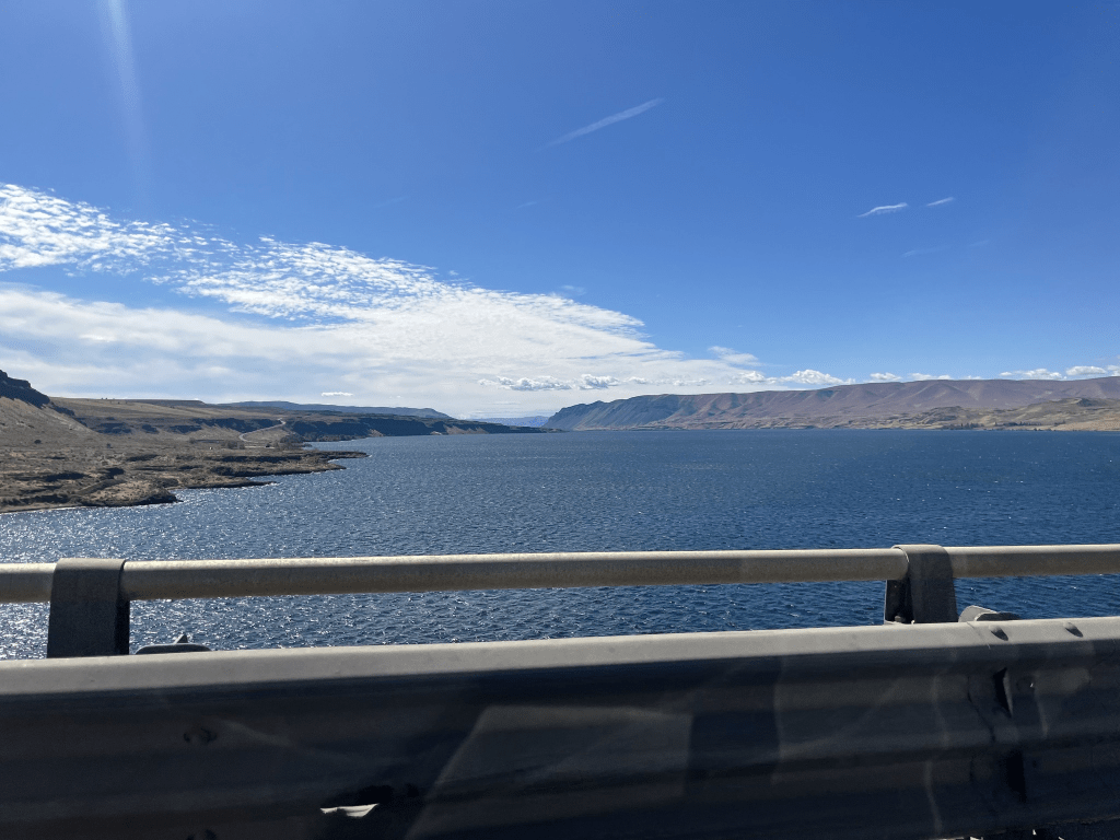
The Columbia River Gorge
It’s hard to put it in words because there is a realization that this is a very big world compared to us, and when you are on the road in the wilderness that scale is clear. After a long haul, we made it to Missoula in Montana in day one, and after a long drive, we both felt like a beer would be welcome. We found a beer and wine bar in town and settled on a Lager.
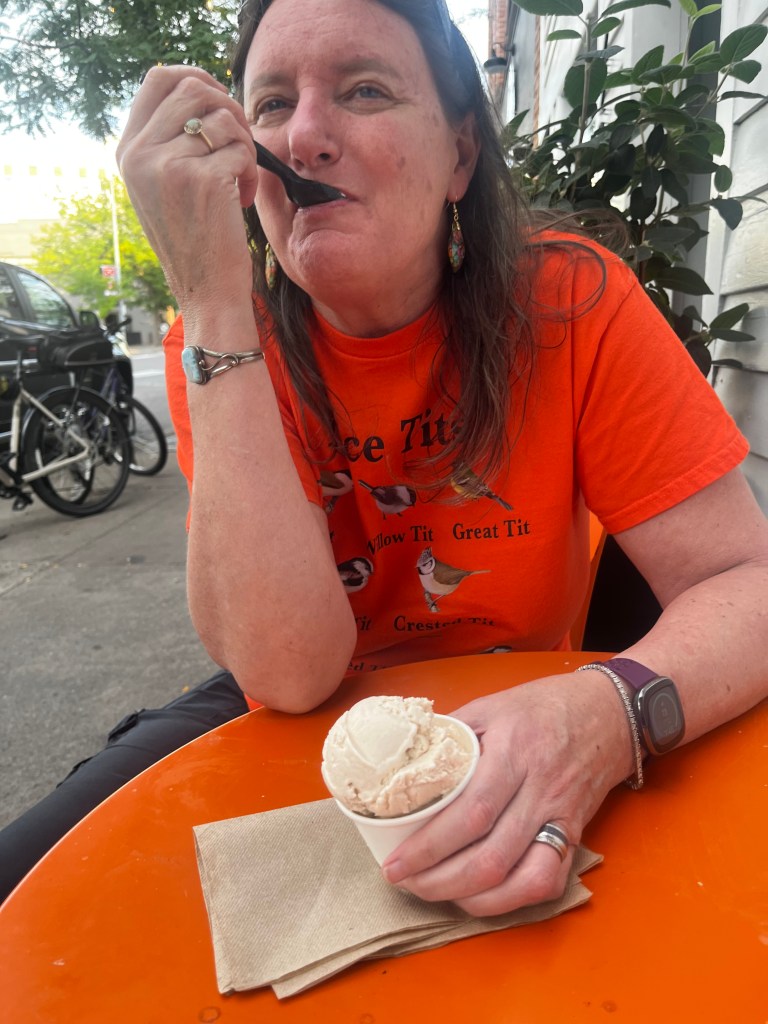
After which, Heather, who had put a challenge out on the day to try a new ice-cream took us to a local ice creamery for a treat.
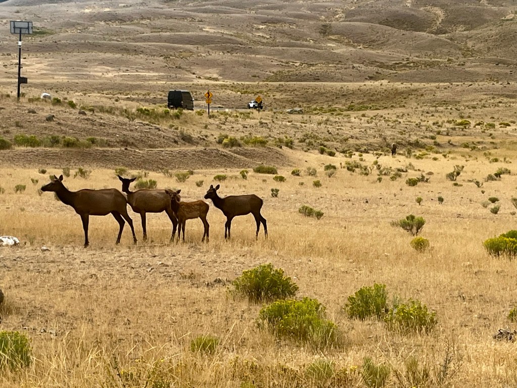
The drive across Montana was beautiful. We intended to enter Yellowstone National Park at the North gate, both of us having been through the West gate in the past, so we could explore the side of the park neither one of us had seen before. It was a very beautiful drive, often made so by the cloud formations. This video is actually taken on the road between Missoula and the North gate of the park. It’s big country.

Once we got to Yellowstone, we were greeted by a herd of Elk at the gate.
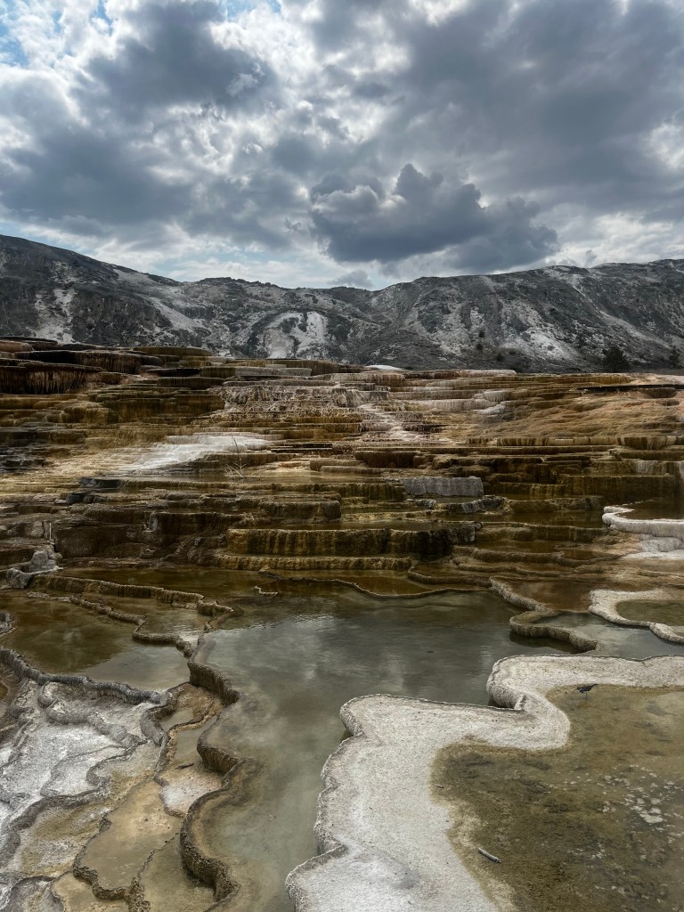
Driving through the park is surreal. Every turn in the road presents another picture postcard. It really does take your breath away to see those wide open, beautiful scenes one after another. Then of course, Yellowstone is an active mega caldera. The preferred scientific terms for Yellowstone are caldera system or caldera complex because “supervolcano” is a colloquial term without a scientific definition and can be misleading, implying only massive eruptions rather than the complex history of multiple, overlapping caldera events and volcanic features within the caldera system. Yellowstone is characterized by an enormous caldera, a large depression formed by a past explosive eruption that collapsed into the empty magma chamber. The point is that if it were to erupt again, I imagine a catastrophe like the last time it erupted covering the entire mid-West in 50 feet of ash. To say we were nervous is not quite accurate, more like being on high alert the whole time. Suffice it to say that the scenery is amazing as these images illustrate.
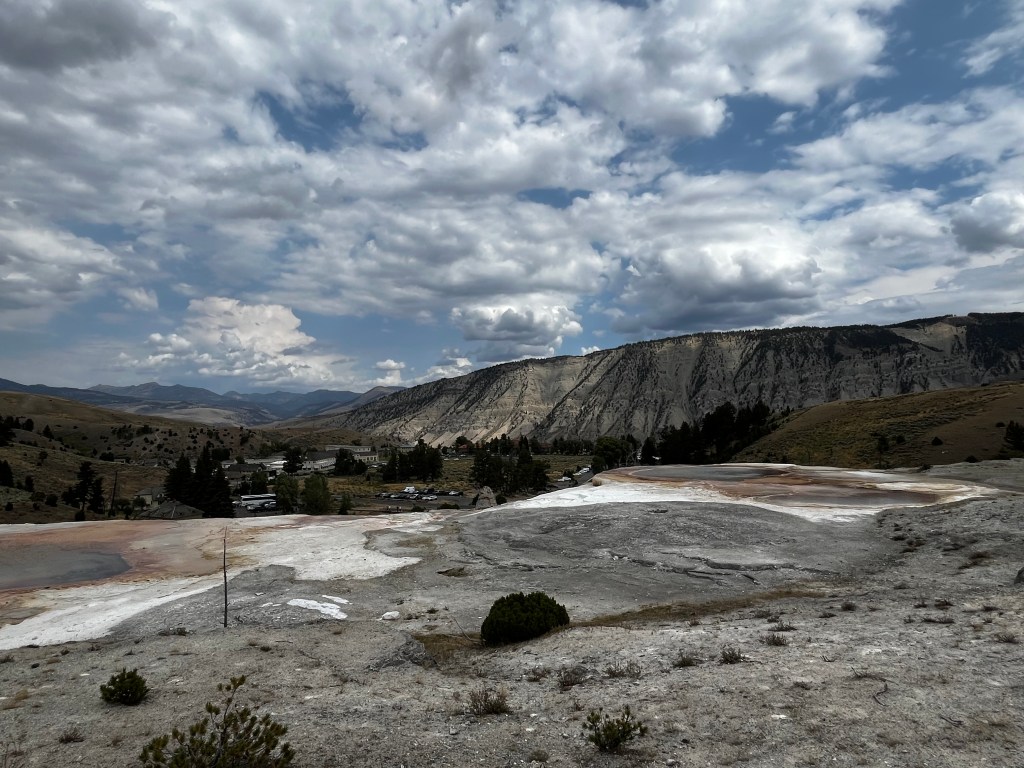
Here we are at Jupiter Spring. It’s a mineral spring that left these rocks bone white with minerals.
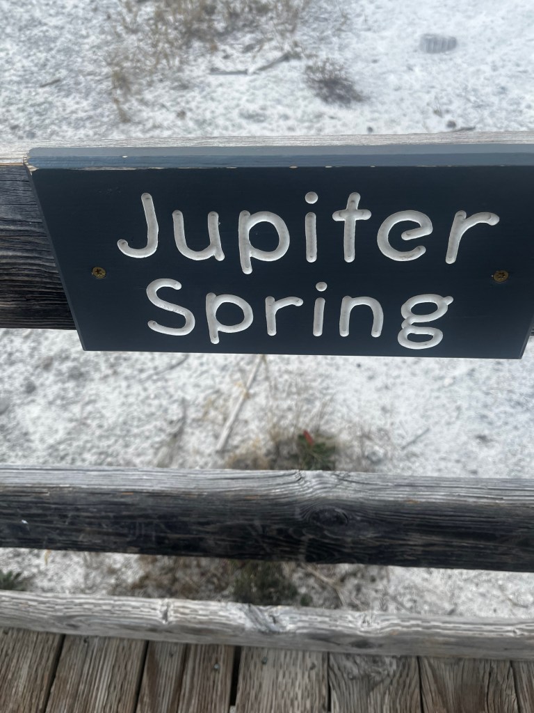
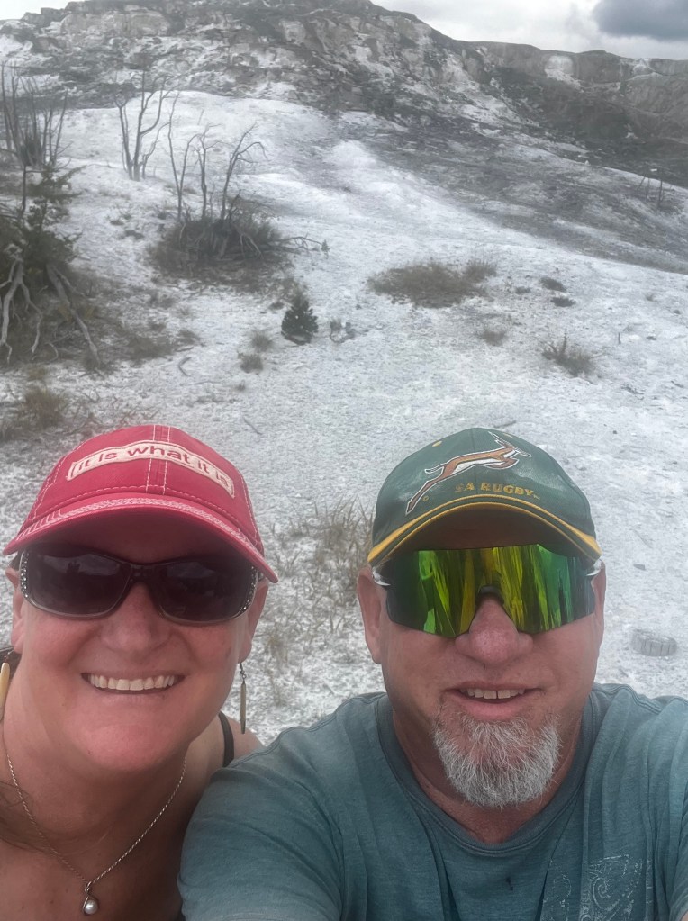
The colors and smell (sulfa) tell you that you are not walking on the ground, and that you will stay on the boardwalk! One of the things that was so impressive to us here was the evidence that life is so resilient. Here we see a lone tree growing on this mineral encrusted mound.
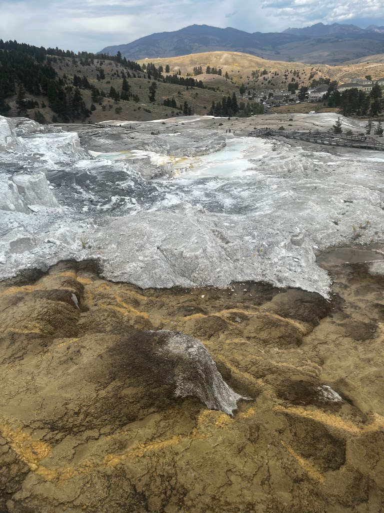
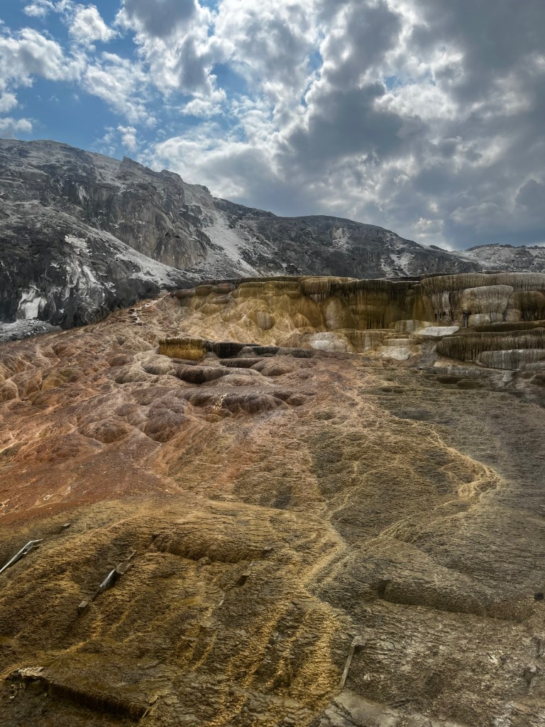
The colors are impressive for sure, and you can see how the land is impacted by the minerals bubbling up. The rangers at the park have built a great boardwalk that lets you get close, but not too close.
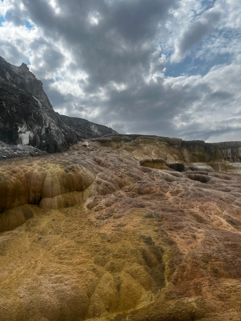
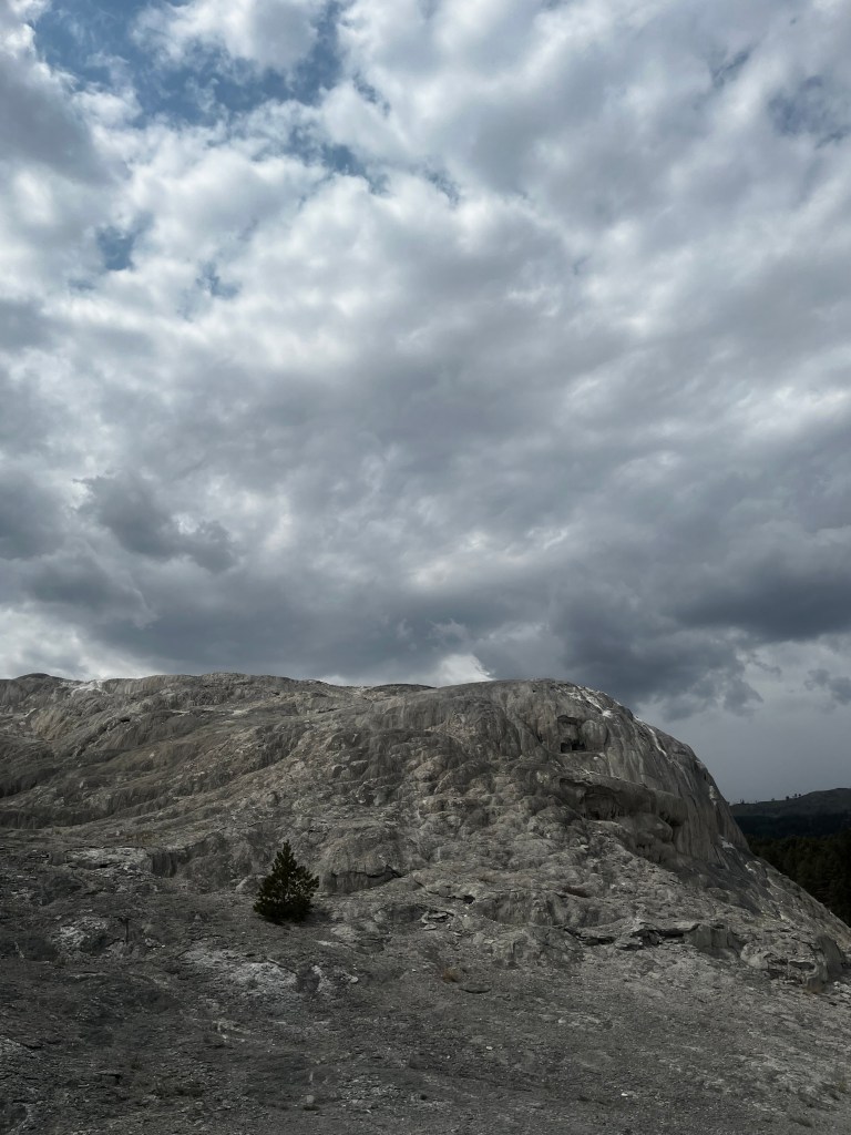
The rocks are covered in sulphuric acid when this area bubbles up. As it cools, you can see the amazing rock formations, made more dramatic by the cloud formation. We thought the top image would make a great jigsaw puzzle!


Every photo taken feels like it could tell a whole story.
There are no end of tales of people losing their way and falling into a pond only to find that it is either boiling hot or made of pure sulfuric acid!

It’s pretty amazing to stand side by side with natural features like this. You really get present to the fact that we are tiny, soft and fragile creatures compared to the natural world.

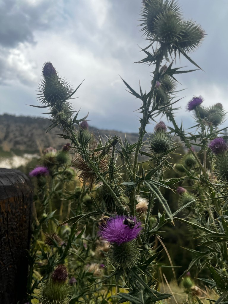
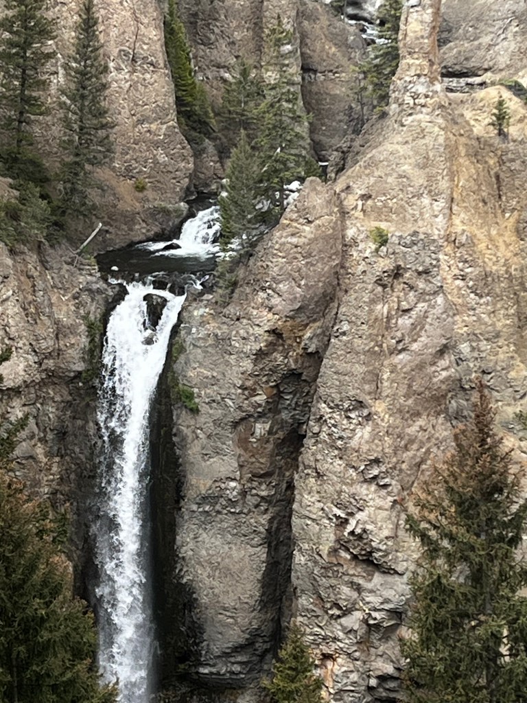
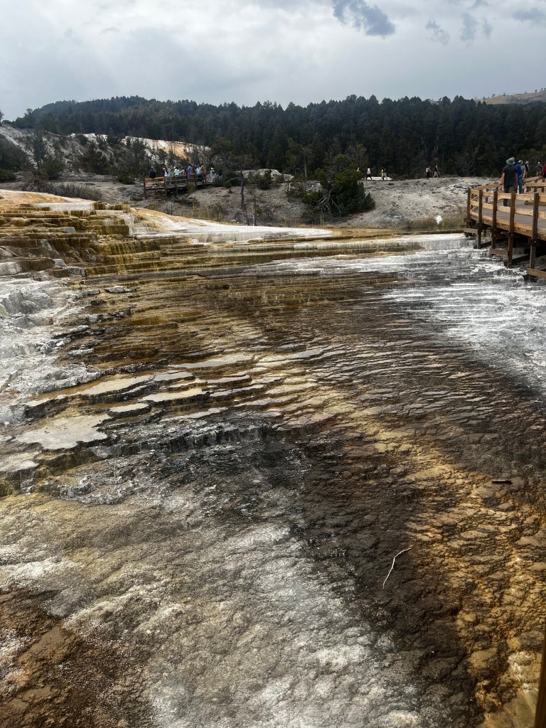
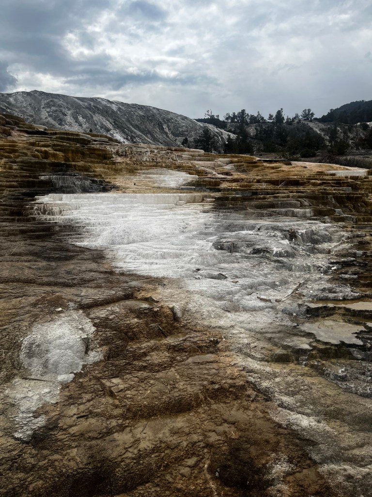
Seeing plants thrive where ever they can in this hostile land is quite remarkable. The tenacity of life sprouting in any available crack is amazing. Then you drive around a corner and find a waterfall!

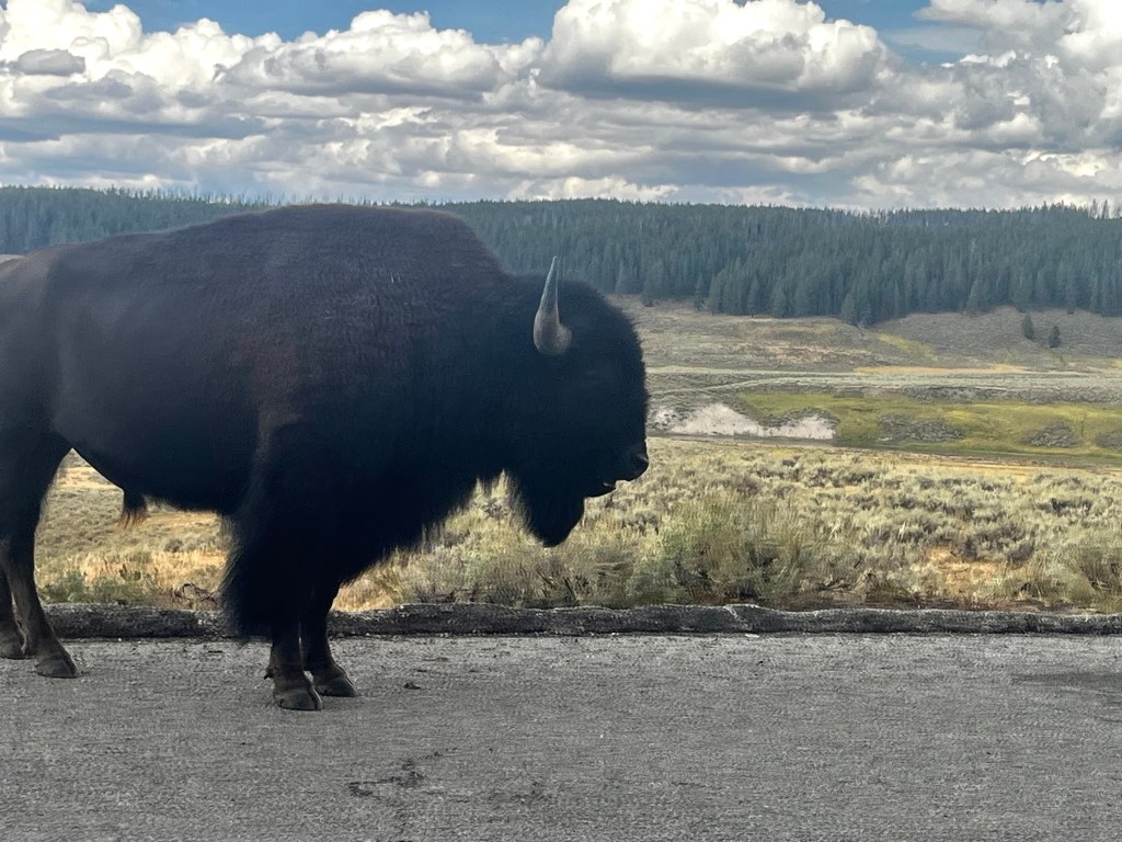
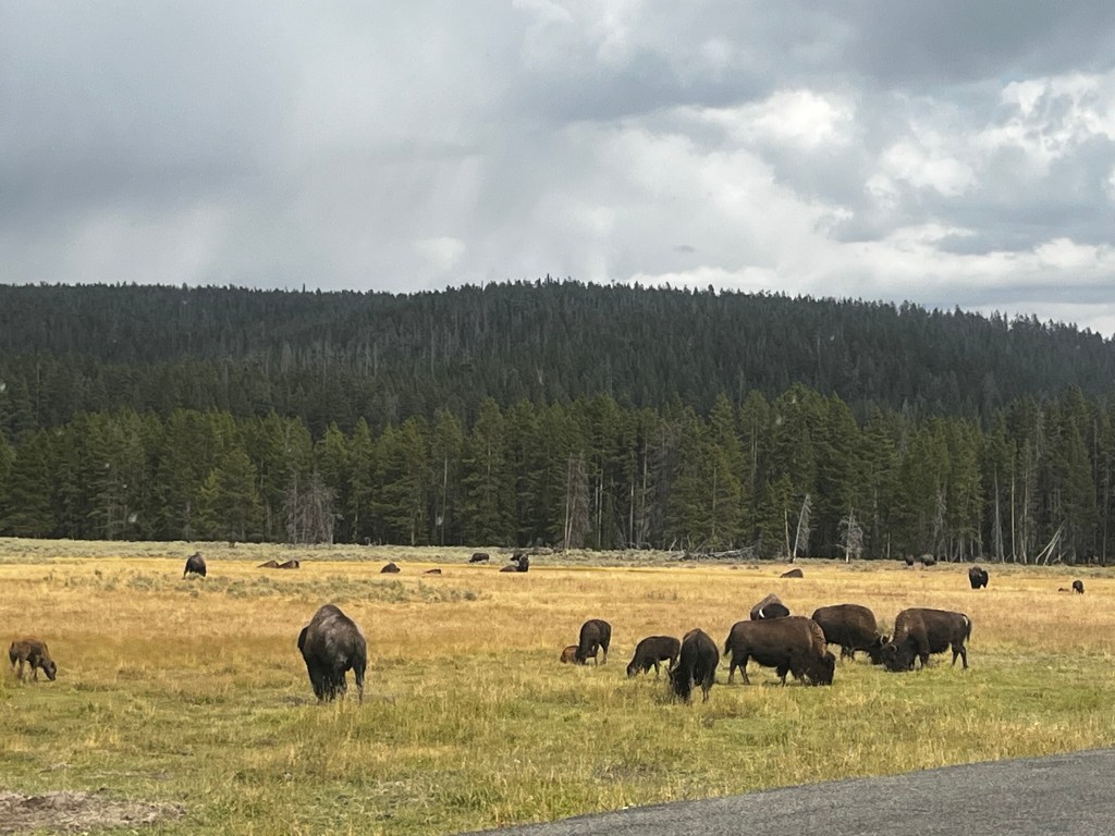
The park is beautiful. One minute you are next to a toxic to plants bubbling sulfuric acid pool, the next a waterfall, and the next a meadow teaming with Bison! If there is one thing we learned, it was that when people see Bison, they stop the car!

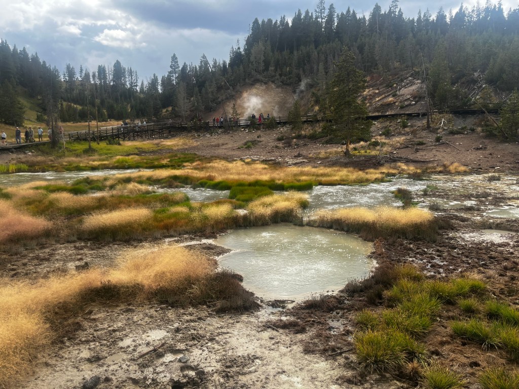
Then you drive around another corner and come to a sulfuric acid pool that looks like it’s boiling! You literally feel like you are standing in the Caldera and it’s active!
When you see this, it looks like it’s boiling, but its only 160 degrees. The turbulence and the bubbling is the sulfuric acid and the bacteria in the pond off-gassing. Even the “waves” that are coming forward are generated by the sulfuric acid.
Here is another smaller pond down stream. Again, it looks like it’s literally boiling hot, but its not. It will still kill you because it’s pretty hot at 160 degrees, but its the sulfuric acid that will get you. There are so many stories of people mistakenly getting into or falling into pools like this only to suffer a horribly painful death!
Then you look and see a Bison wondering down the road!
You literally drive for 6 minutes and the next thing you see is a field of Bison!
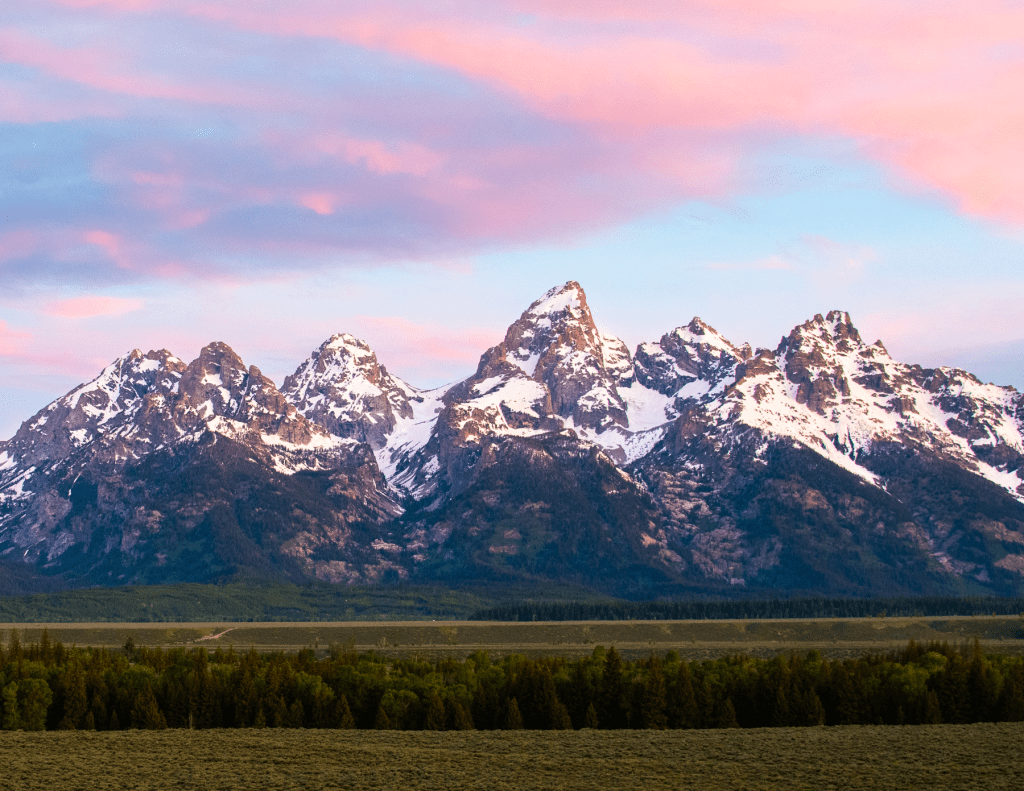
One thing I will say about our adventure is that the scenery around the West is beautiful. There was never a dull moment visually. The drive from Yellowstone to Moab took us through Wyoming where we saw the Grand Tetons which I had never seen before. They are really young mountains geologically speaking, and they are an epic sight!

We stopped in Victor, a little town in Idaho where we ate breakfast at a little diner called Butter. It was the best meal we had on the trip! Here are my huevos ranchero which was delicious!
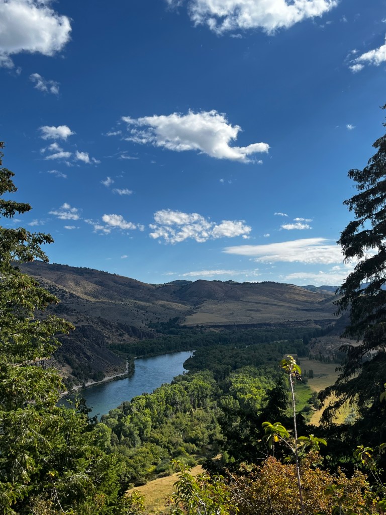
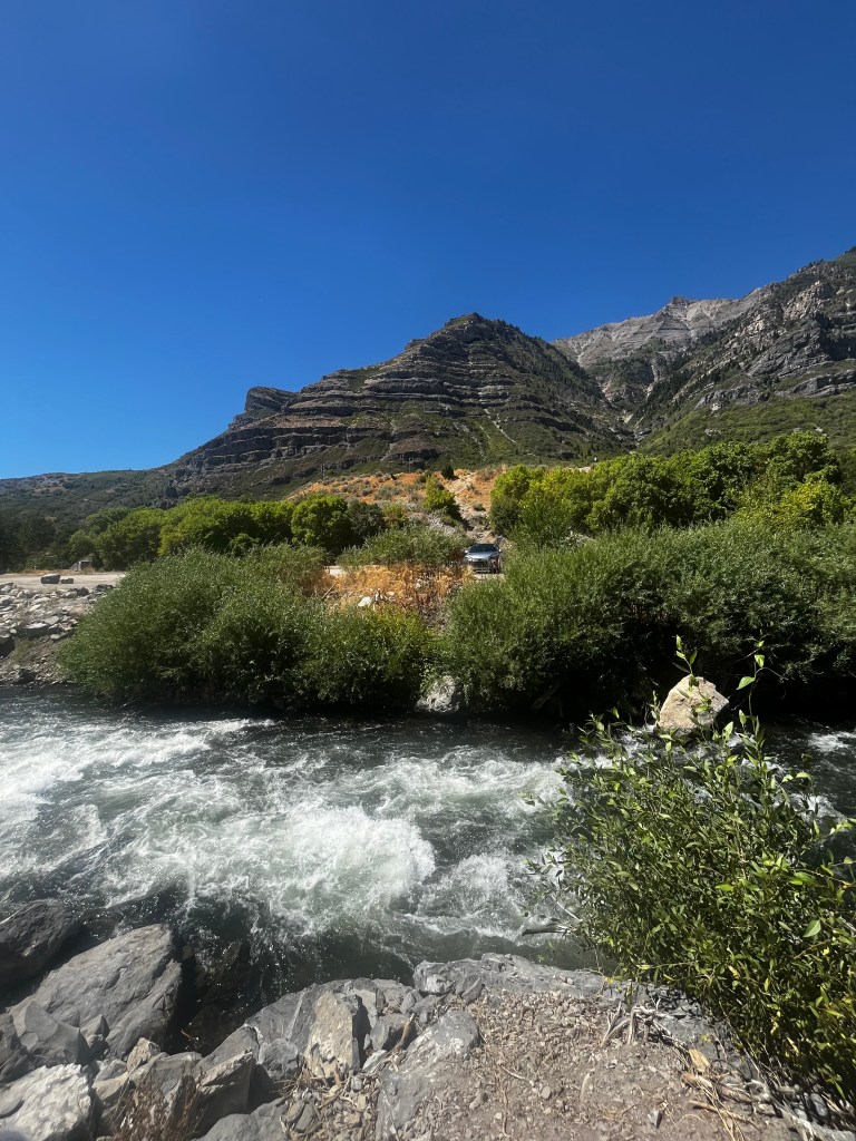
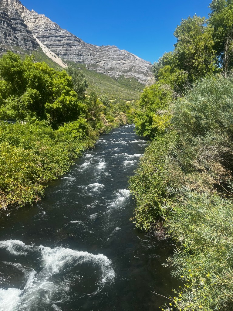
The views kept coming. The drive through Idaho was quite scenic too! This is the Snake River.
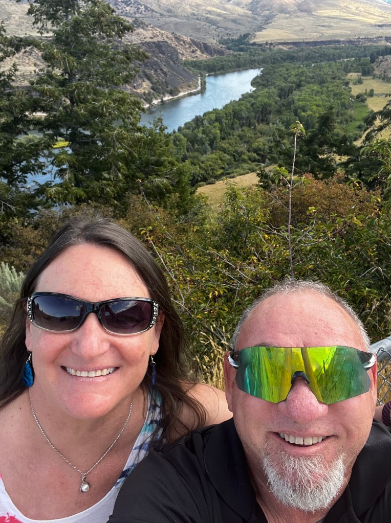
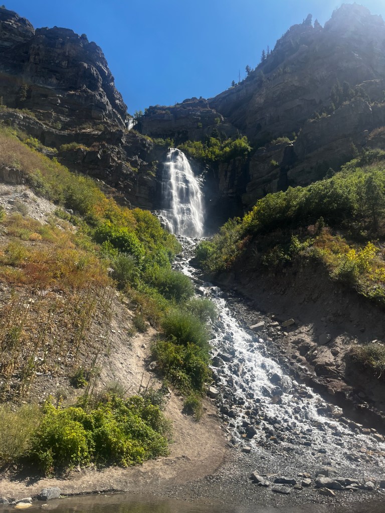
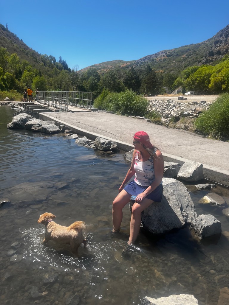
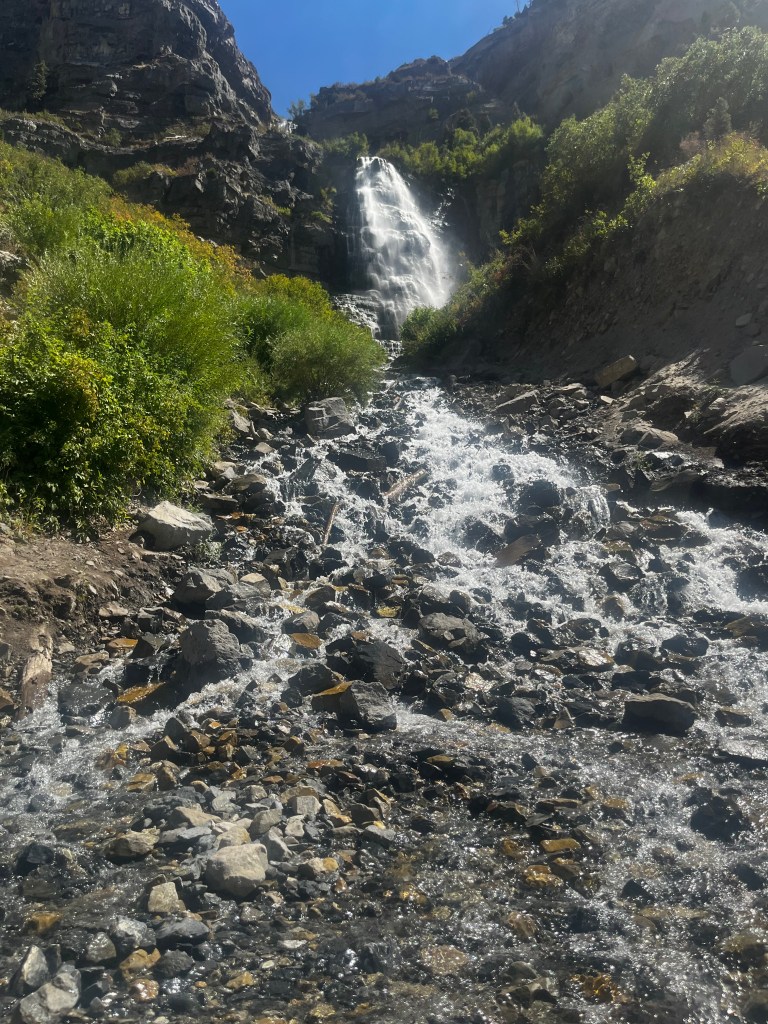
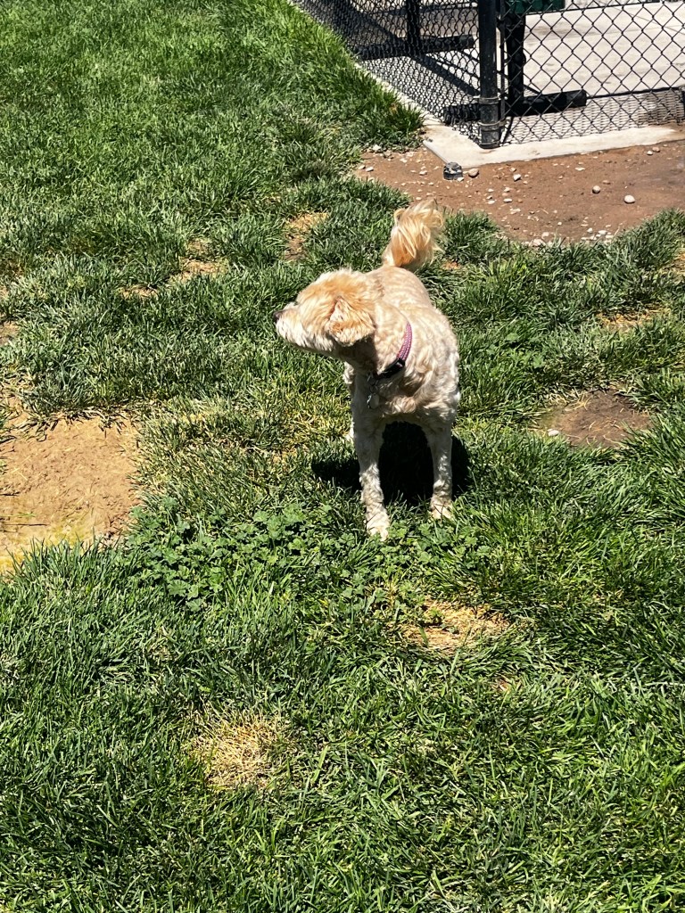
Once we got through Idaho we went through Utah and got to Provo, here we went to the Cedar Hills falls. A little waterfall that was ice cold where the kids and dogs played in the rock pool. We took a minute to soak our feet and let the dog get wet since it was well over 90 degrees that day, and we had been in the car for hours.

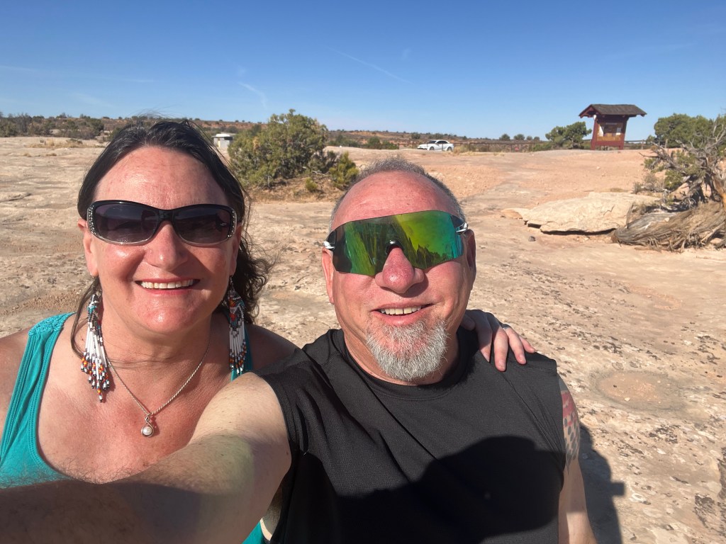
The obligatory selfie then Heather and Kiva cool off!
We had a longish day in Provo since our drive was shorter on that last leg, so we picked up a bottle of tequila, & some limes and made ourselves margaritas. Luckily, the motel was across the street from Arby’s so we did not have to drive for food. (Truth be known, I have a secret love of Arby’s, so that worked out perfectly). The drive from Provo to Moab was also quite pretty, esp as we left Provo.
As we got closer to Moab, the terrain changed and we moved into a high desert, and in the town of Price, we found a Prehistoric Museum operated by Utah State University (Coincidently, the University where I did my Masters degree!)
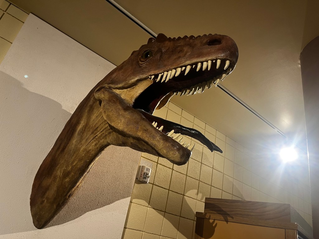
During the Precambrian, the area of northeastern Utah now occupied by the Uinta Mountains was a shallow sea which was home to simple microorganisms. During the early Paleozoic Utah was still largely covered in seawater. The state’s Paleozoic seas would come to be home to creatures like brachiopods, fishes, and trilobites. During the Permian the state came to resemble the Sahara desert and was home to amphibians, early relatives of mammals, and reptiles. During the Triassic about half of the state was covered by a sea home to creatures like the cephalopod Meekoceras, while dinosaurs whose footprints would later fossilize roamed the forests on land. Sand dunes returned during the Early Jurassic. During the Cretaceous the state was covered by the sea for the last time. The sea gave way to a complex of lakes during the Cenozoic era. Later, these lakes dissipated and the state was home to short-faced bears, bison, musk oxen, saber teeth, and giant ground sloths. Local Native Americans devised myths to explain fossils. Formally trained scientists have been aware of local fossils since at least the late 19th century. Major local finds include the bonebeds of Dinosaur National Monument. The Jurassic dinosaur Allosaurus fragilis is the Utah state fossil.
The museum has three collections, Paleontology, Archeology and the Ice Age. The Prehistoric Museum’s archaeological collections contain over one million artifacts, with an emphasis on artifacts associated with the Fremont Archaeological Culture. These farming communities were found across most of what is now Utah from around 400-1300 AD. The museum also stewards artifacts from the Paleoindian period through the historic and ethnographic period. The collection consists of a mix of stone, ceramic, and organic material classes. Perishable materials are well represented due to the incredible preservation environment of the northern Colorado Plateau.
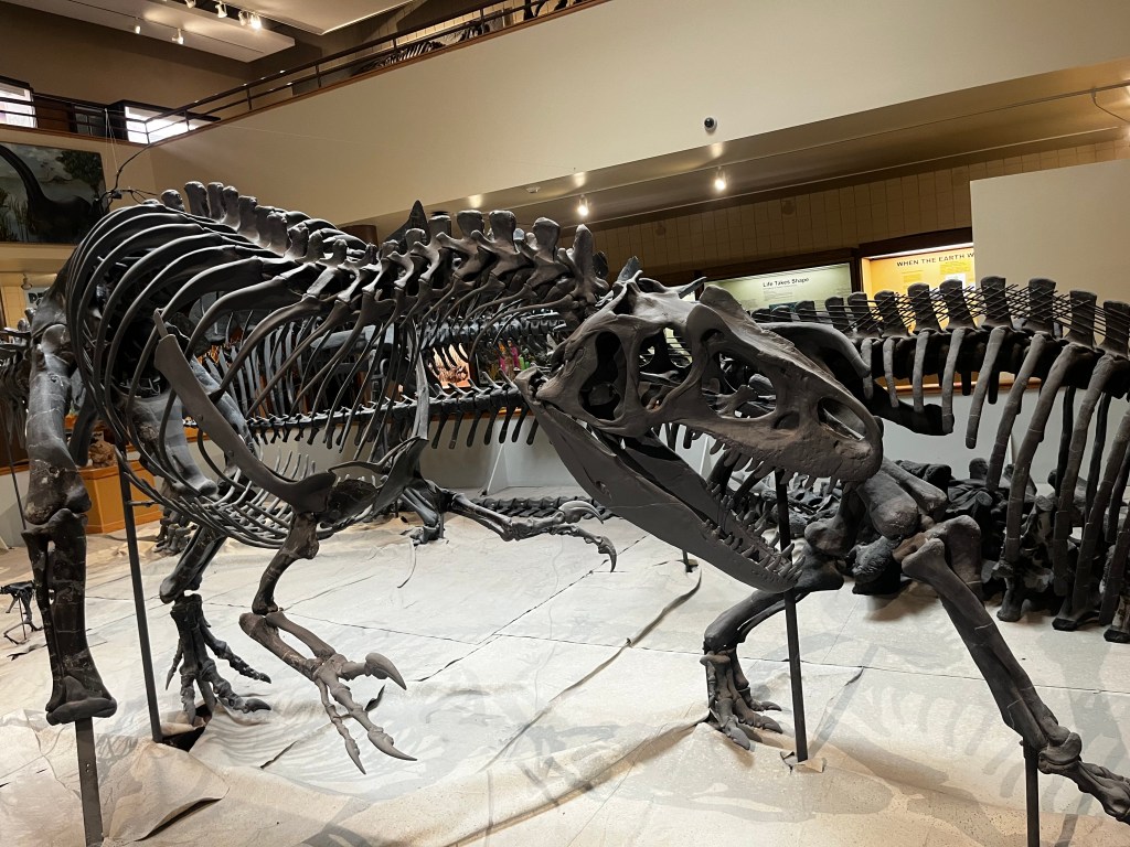
The Prehistoric Museum’s paleontological collections contain over 9000 cataloged specimens, with a focus on Mesozoic fossils from eastern, central, and southern Utah. These specimens have been of international significance, drawing researchers to Price from across the US and the world to access the unique fossils from this region. Other highlights of the collections include vertebrate fossils from the Upper Jurassic Morrison Formation, dinosaurs from the Cretaceous Cedar Mountain Formation, tracks from Cretaceous Blackhawk Formation, vertebrate and plant fossils from the Upper Cretaceous Neslen Formation, microvertebrates from the Cretaceous-Paleocene North Horn Formation, and the Huntington mammoth, a high elevation Mammuthus columbi. This fossil is the Huntington Mammoth.

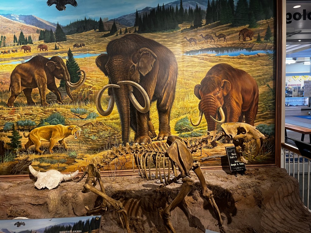
This magnificent animal was discovered in 1988 in the Manti La-Sal National Forest, and is a hairless Columbian Mammoth. The big bull was approximately 15 feet tall and looked a lot like a modern elephant.
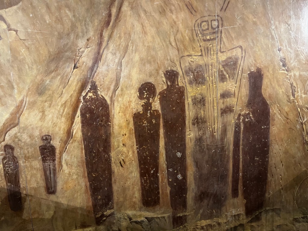
Utah is an extraordinarily rich state in terms of its archaeological past. Indians have lived in every part of the state from extremely ancient times, and have left rock art reminders of their presence in all parts of the state.

They also had an art exhibit called Mutualism with art by Anna Evans.

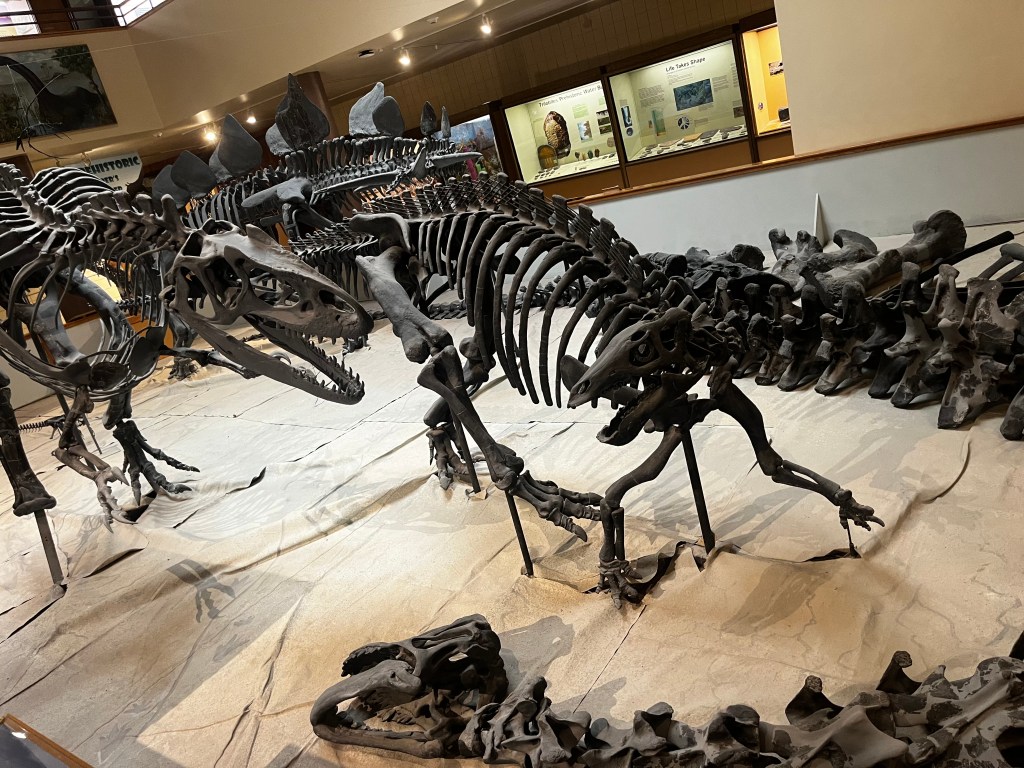
The entire region seems like a dinosaur dig. This part of the United States was first under an ice sheet during the ice age, then as the ice melted, and it turned into a bog, the dinosaurs lived. As time passed their bones got buried. The striations of the rock are visible with grey rock, where the dinosaur bones are found, being areas of low oxygen, while the red layers suggest oxygen was present. In addition, other minerals bring out other colors in the rock. The drive was hot and dry for sure.

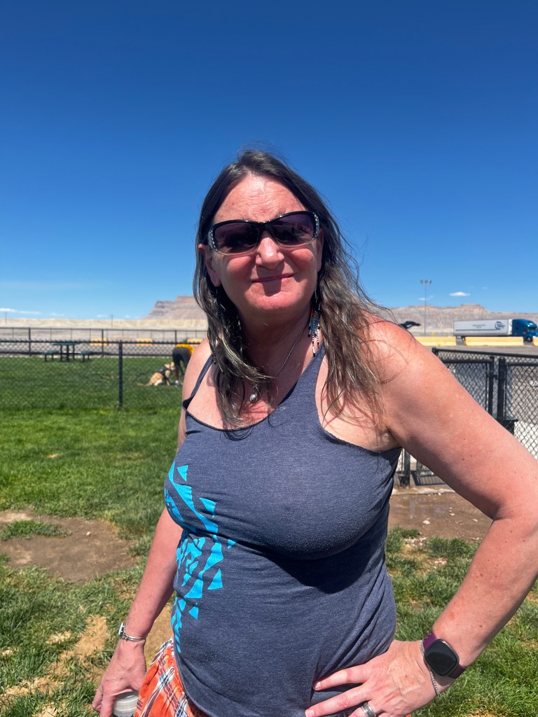
LIke I said, it was very hot in the desert. Kiva wanted to get back into the car immediately!
Heather working on her tan
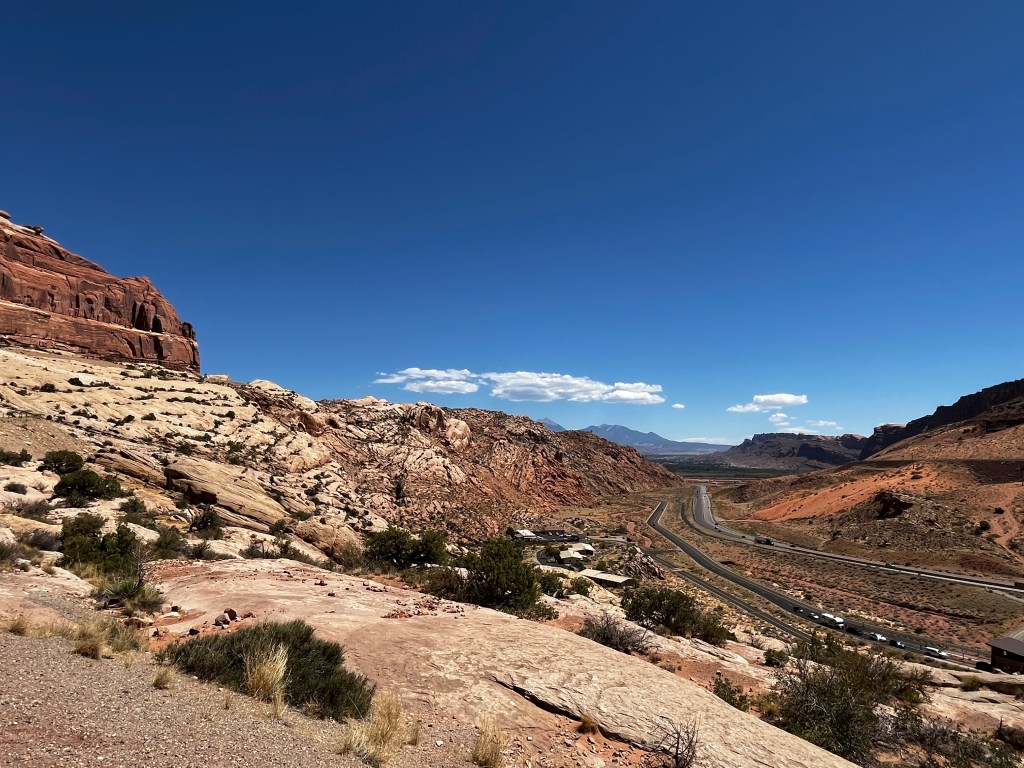
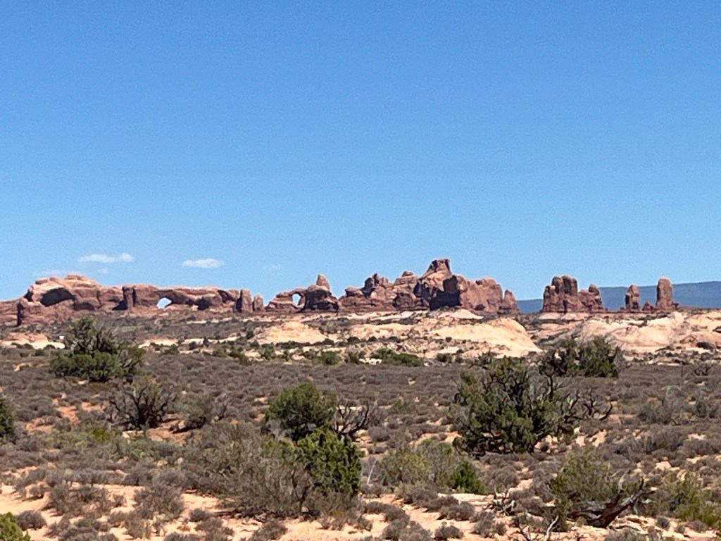
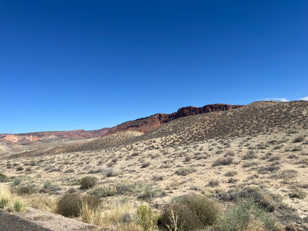
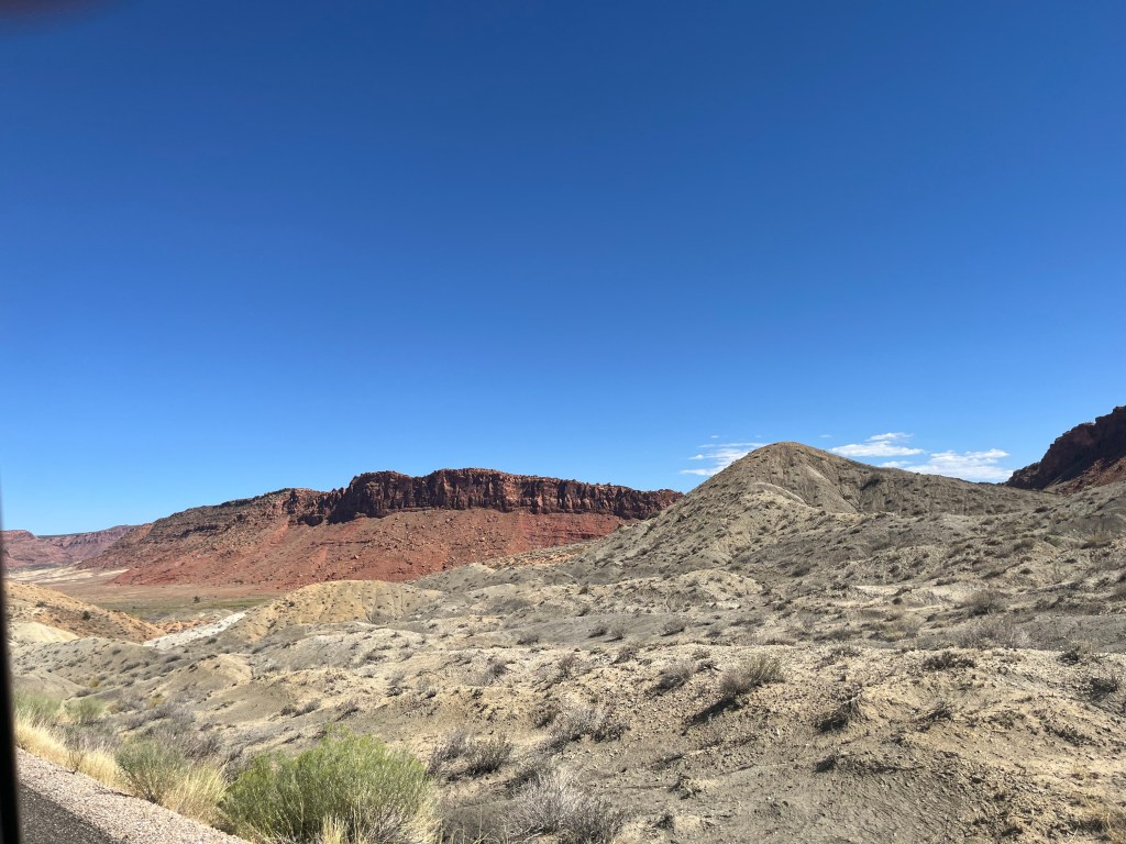
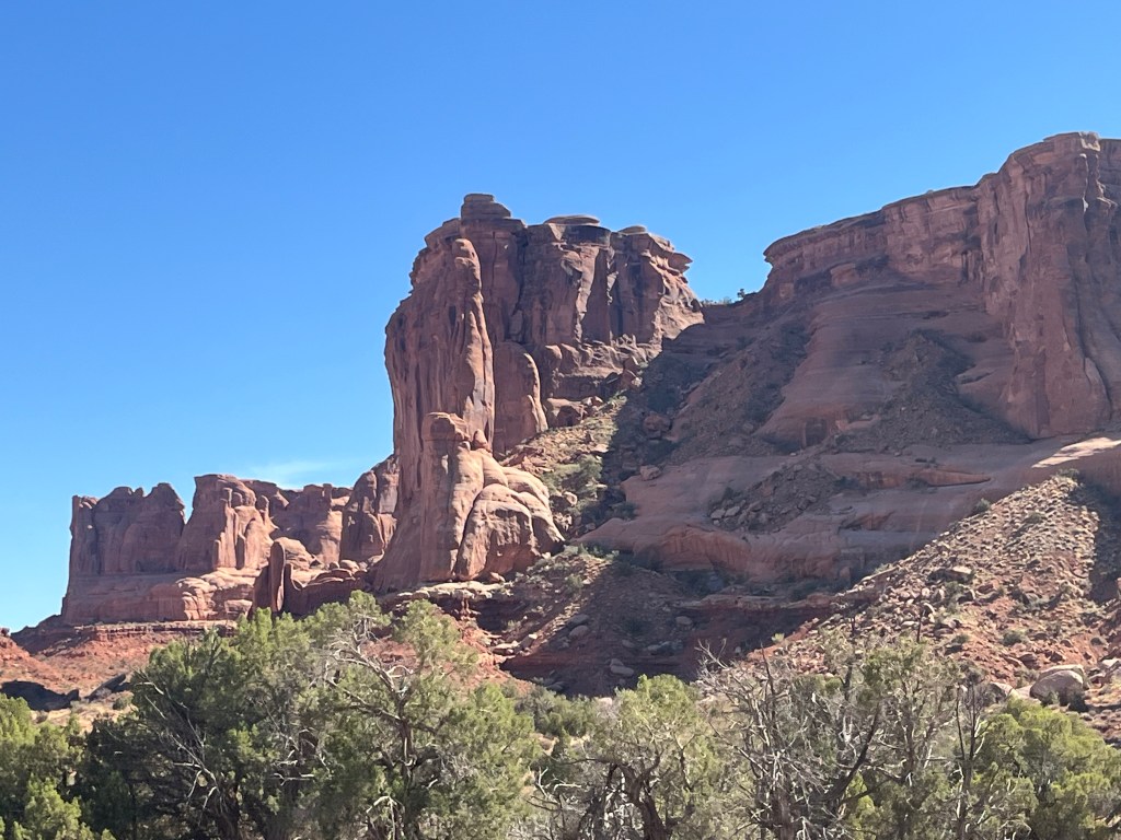
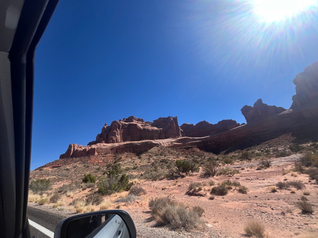
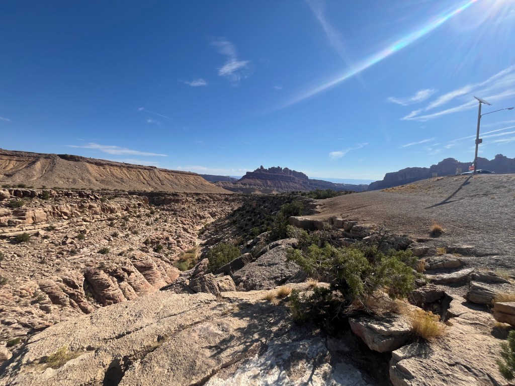
As we got closer to Moab, the scenery changed to the massive red rock cliffs giving us a glimpse of what we were to see in the Arches National Park. It is so hard to comprehend the amazing amount of water that carved these cliffs. On the drive in, you really get the picture that you could be driving across the bottom of the ocean. Then suddenly, the rocks rise out of the dirt.
We finally made it to Arches. This was our first destination. We had identified Moab and in particular, The Arches National Park, the Canyons National Park and the Dead Horse State Park as among the darkest sites in North America, perfect for star gazing.
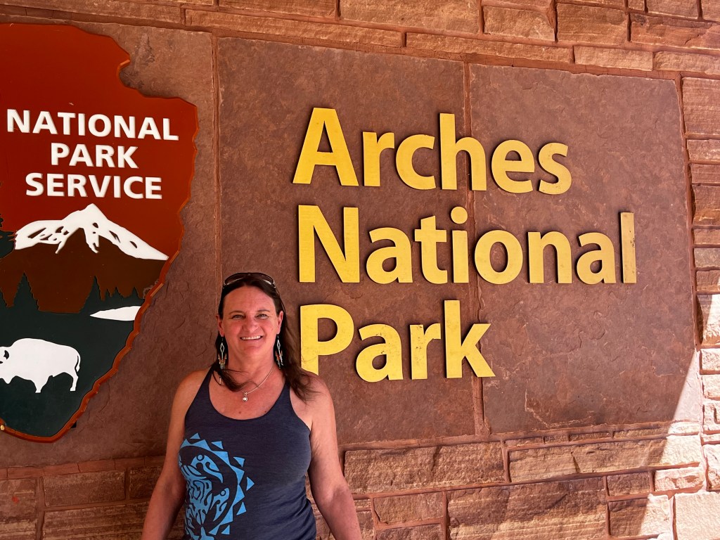
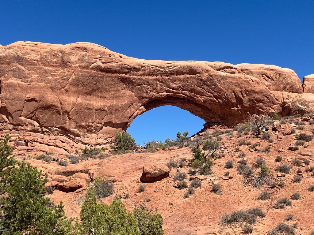
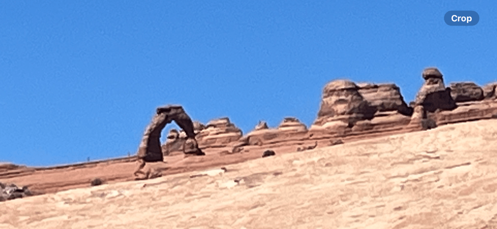
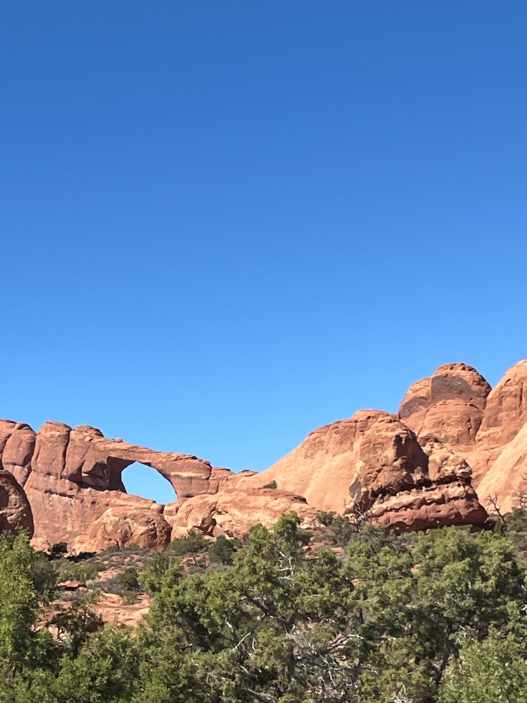
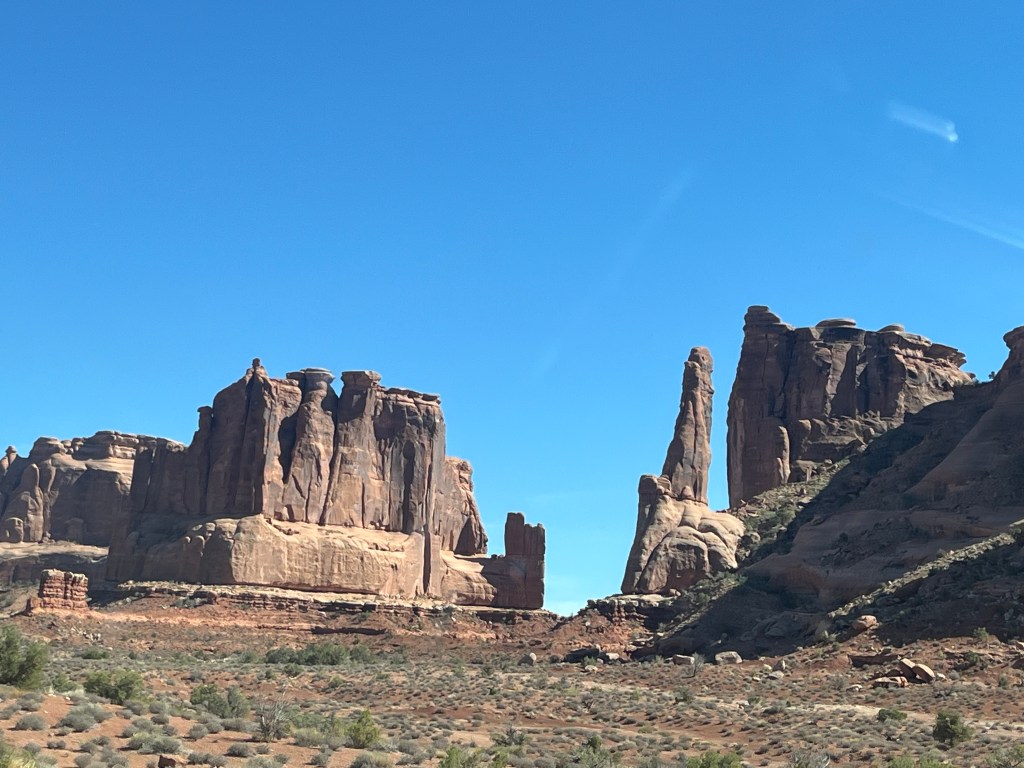
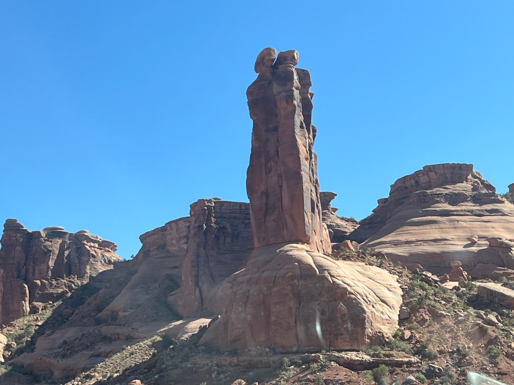
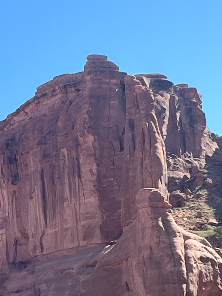
And my-oh-my, it did not disappoint. You pull into the park and once you leave the visitors center, you go pretty much straight up a series of very steep switch backs, always climbing as you meander through the park. It’s hard to describe, and a picture is worth a thousand words.
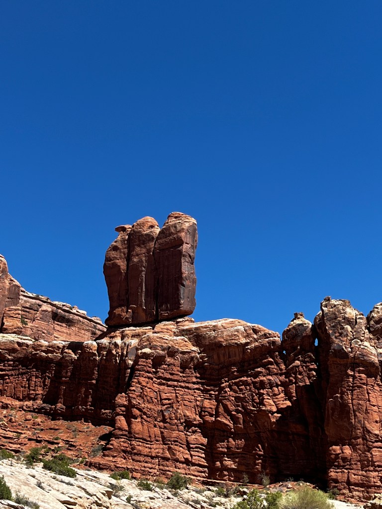

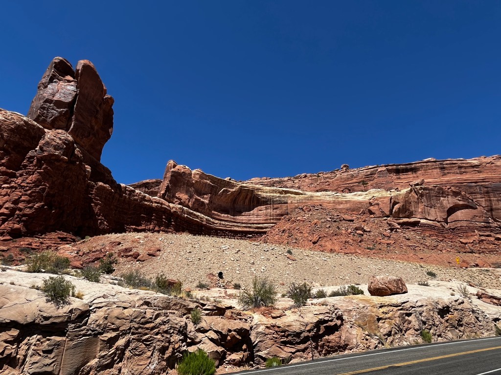


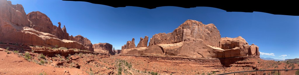
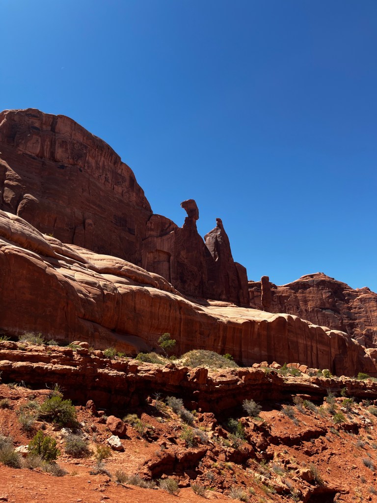
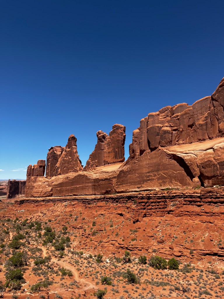

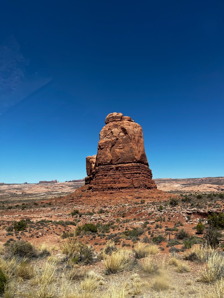
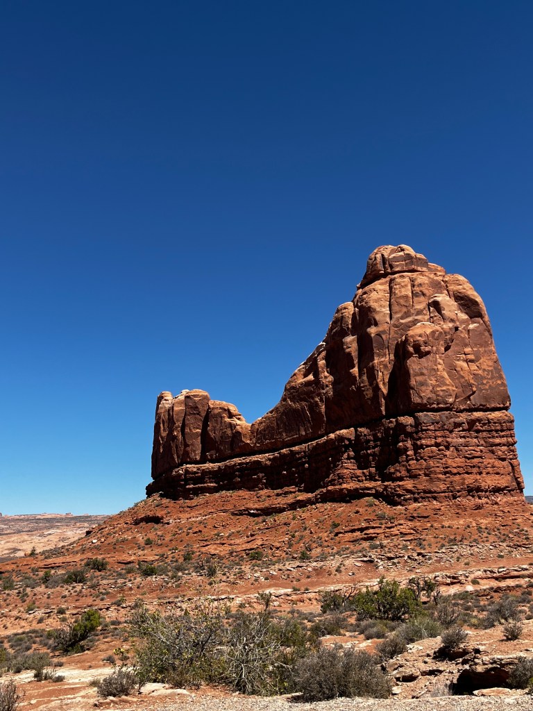

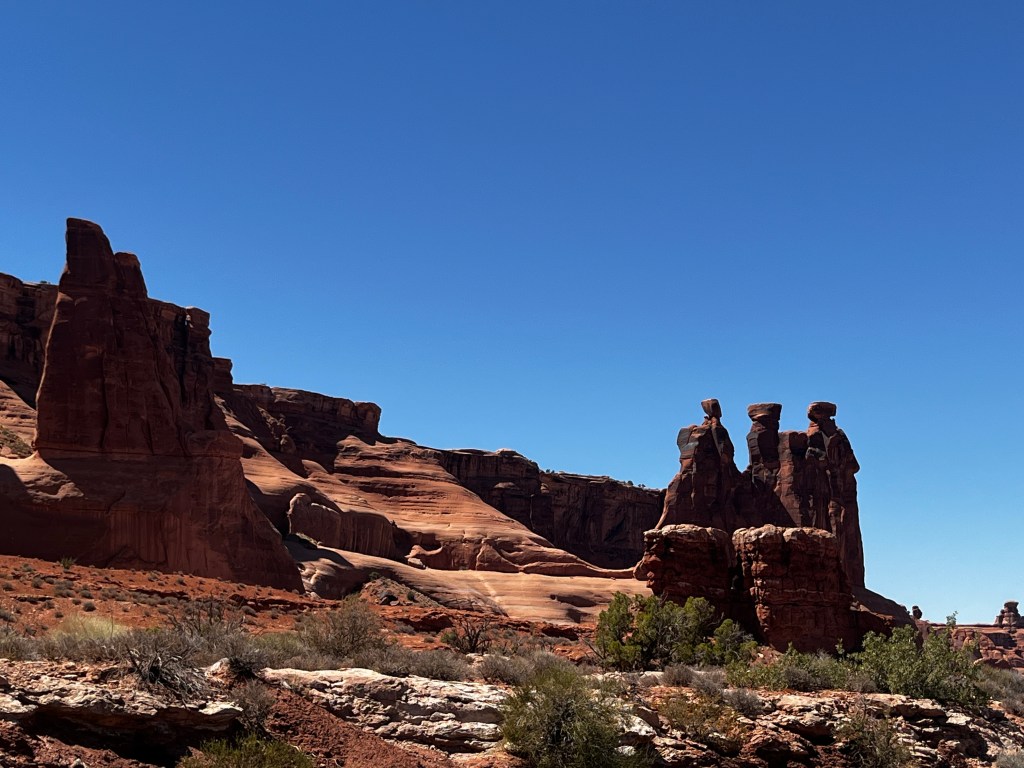
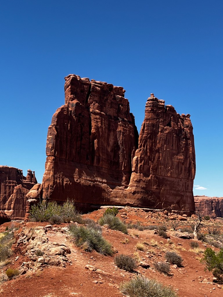
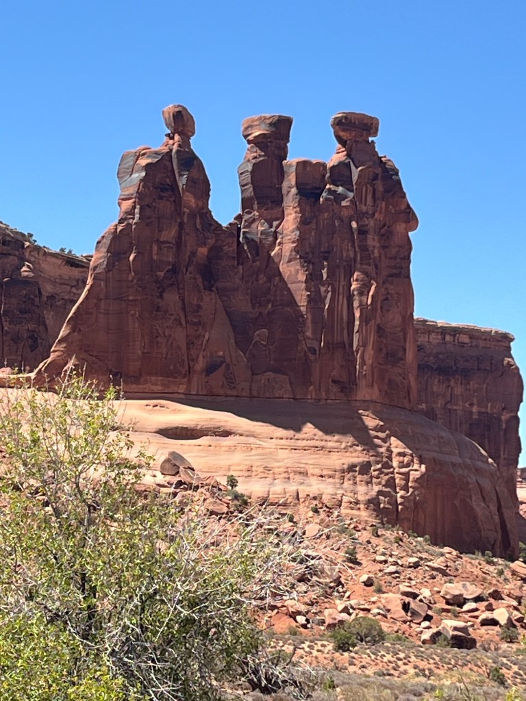
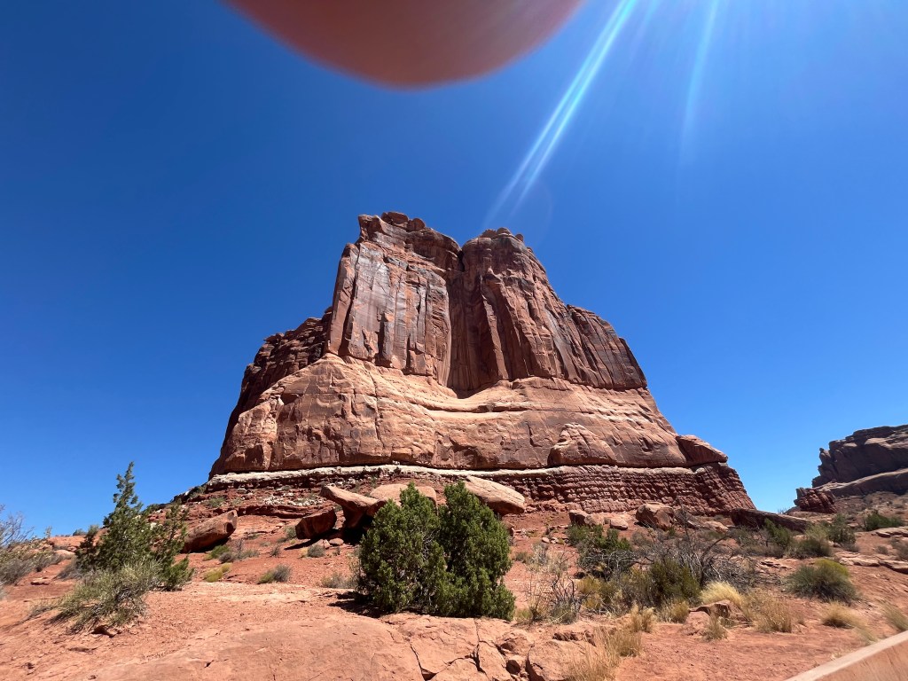
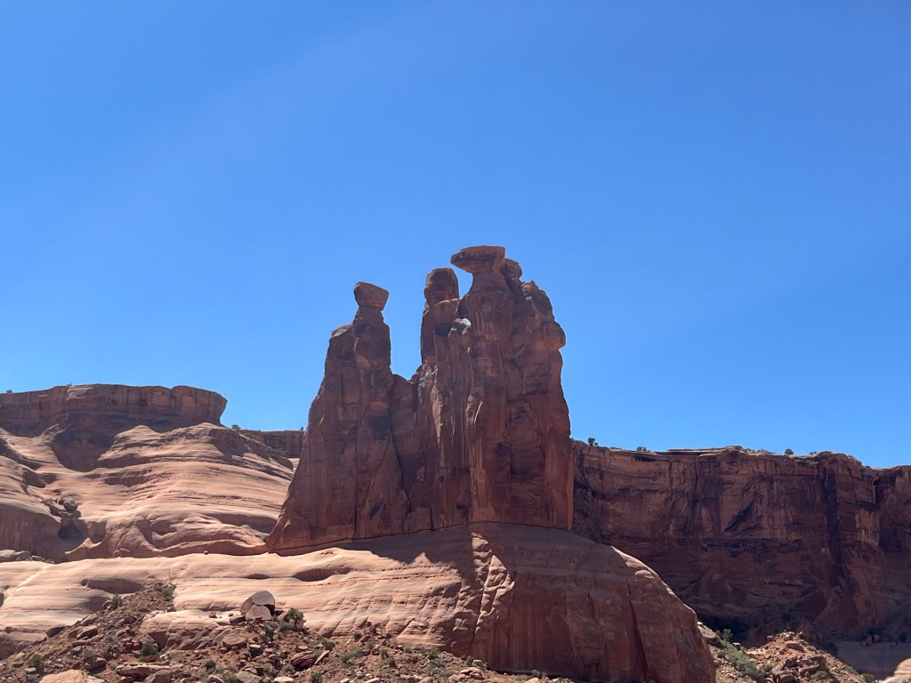
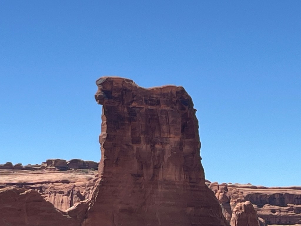

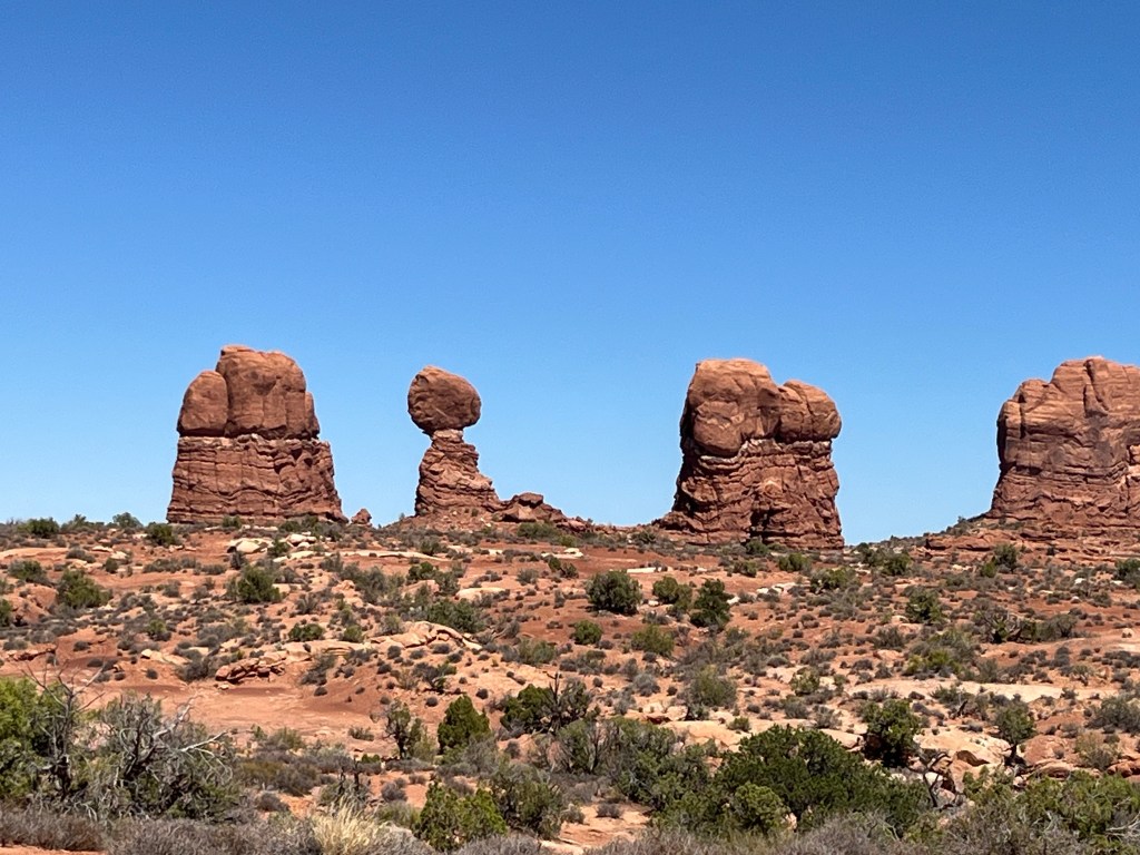
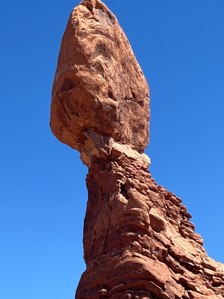
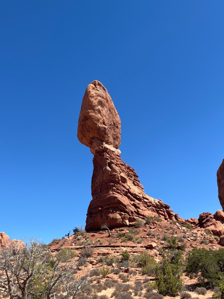
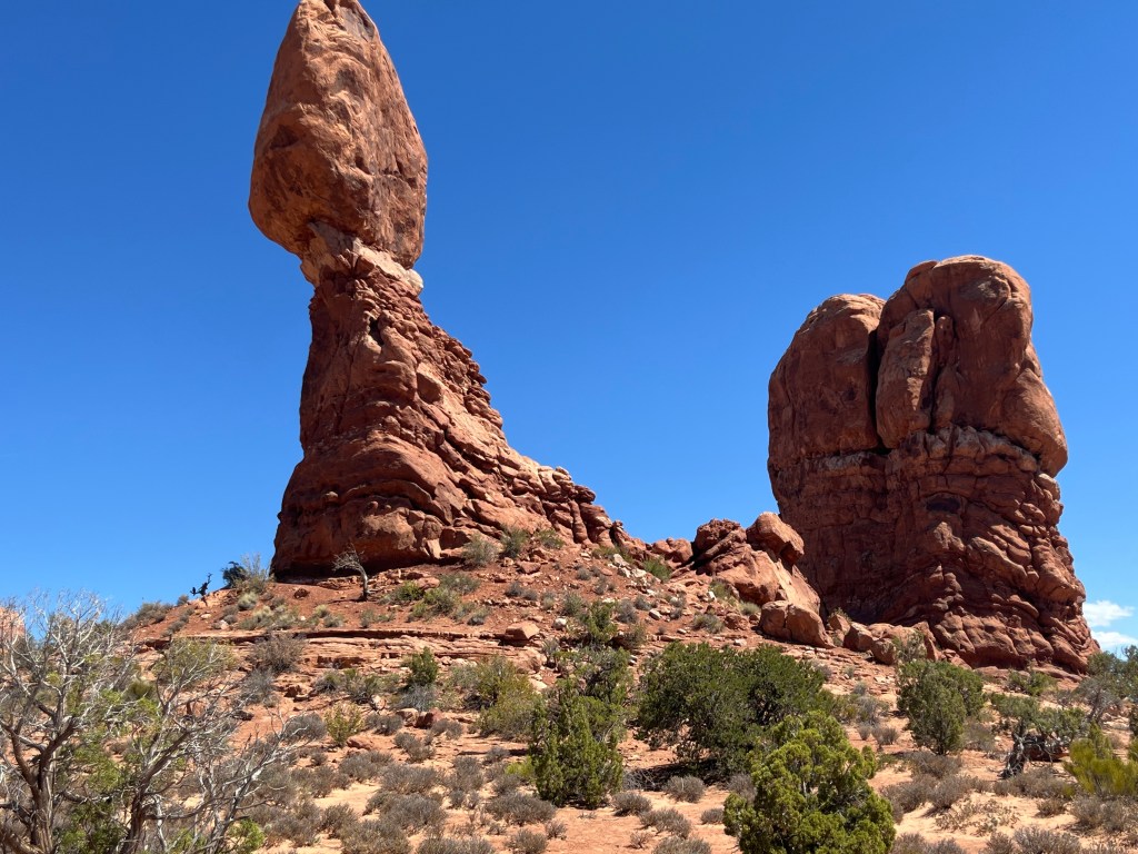
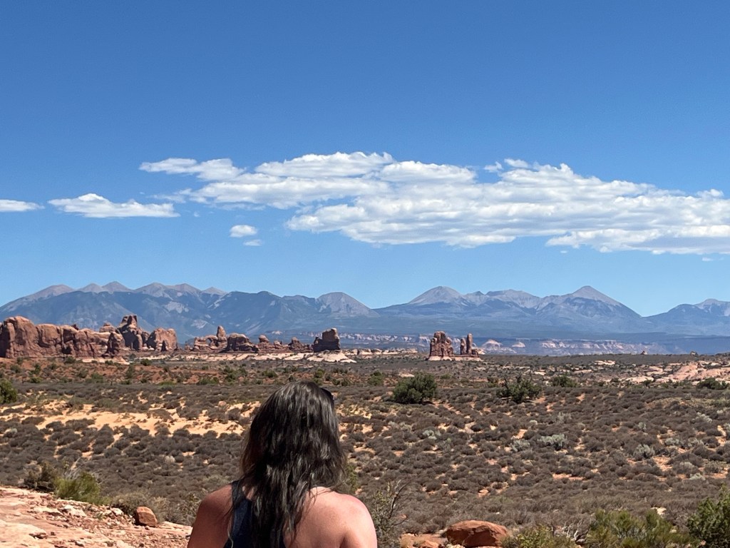
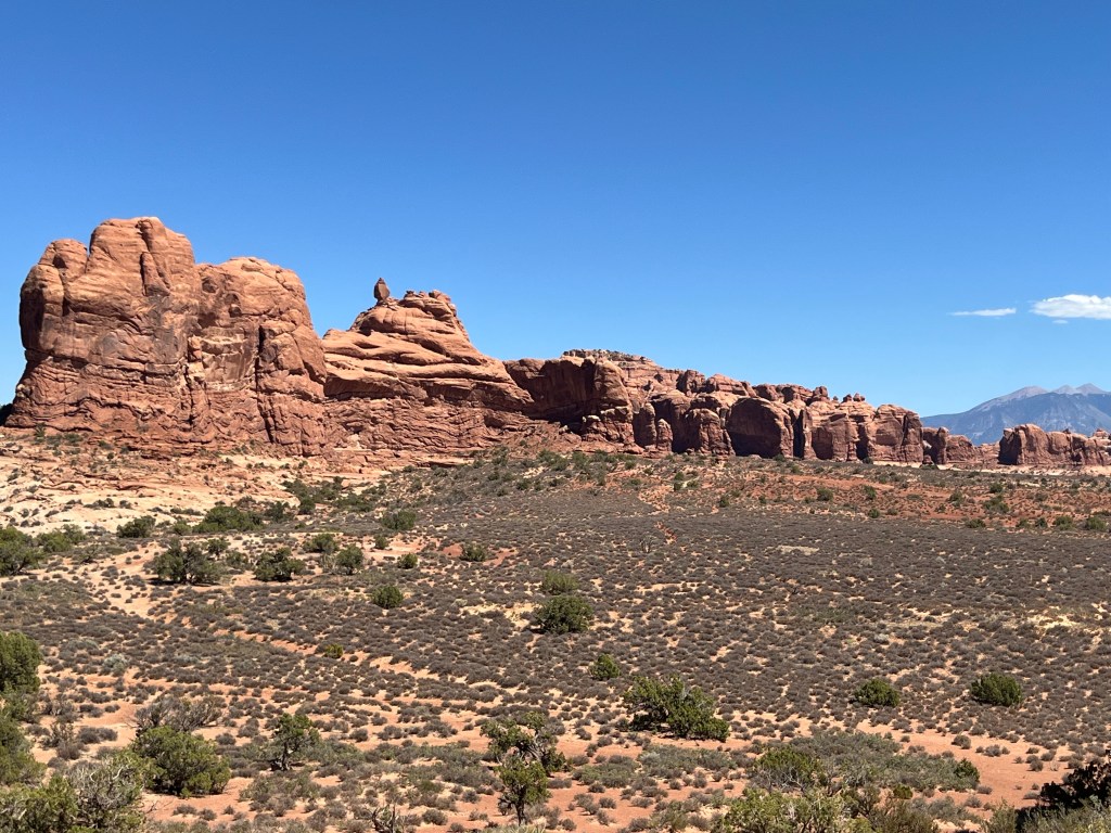

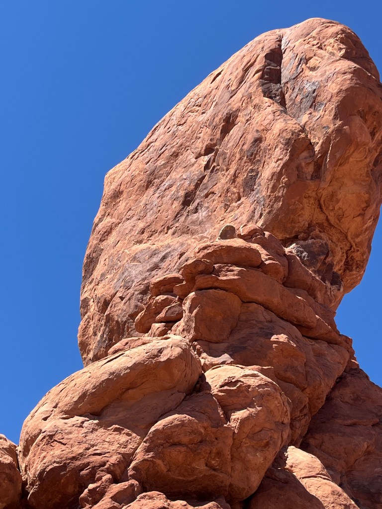

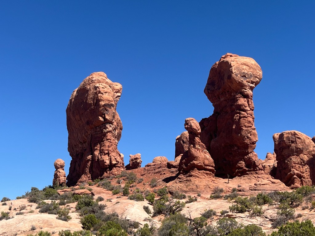
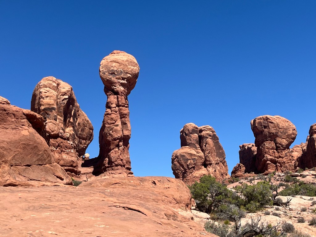
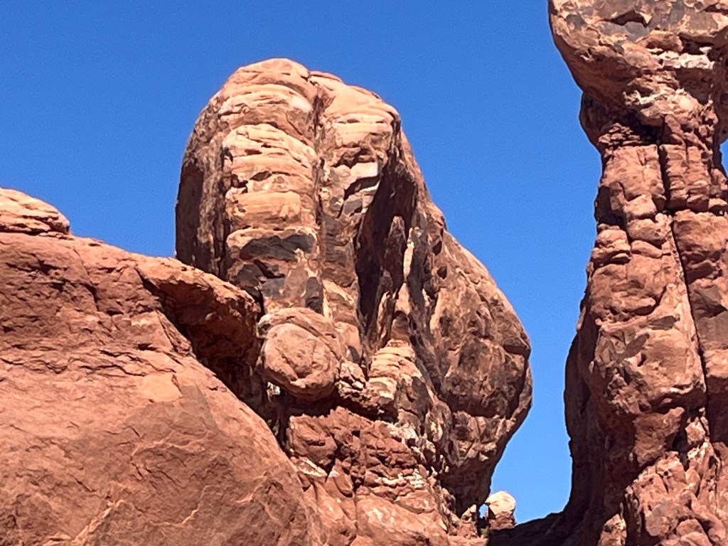

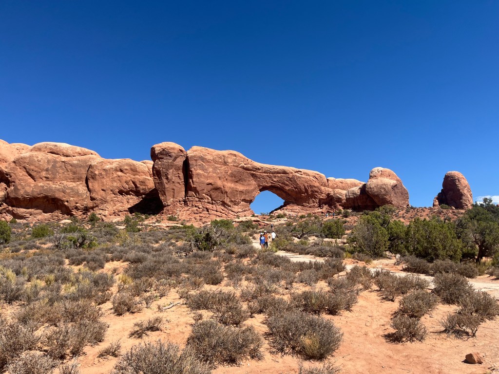
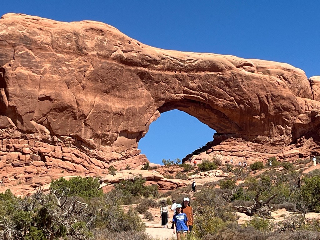
It’s really hard to get the scale of this park. This last image has humans in it to give some perspective, but these rocks are massive, and the fact that they have been worn down by WATER is amazing on it’s face, but when you see how massive they are and how far you have to climb to get to the level where they are, you begin to understand just how much water had to flow through here to cause these types of rock formations.
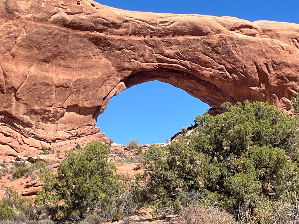

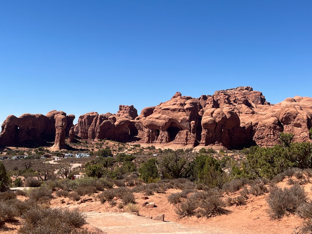

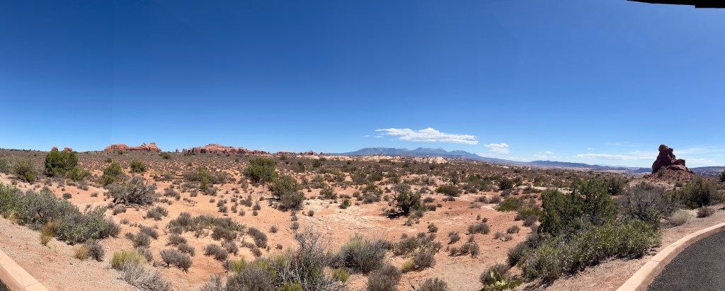
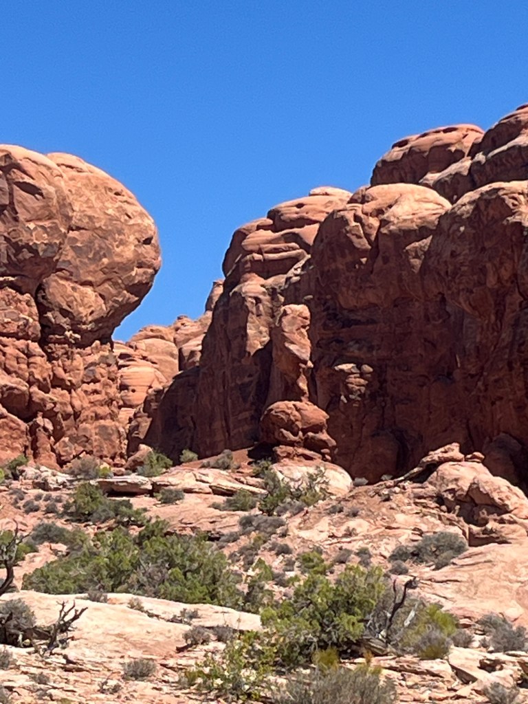
Driving through the park you get a sense of the scale


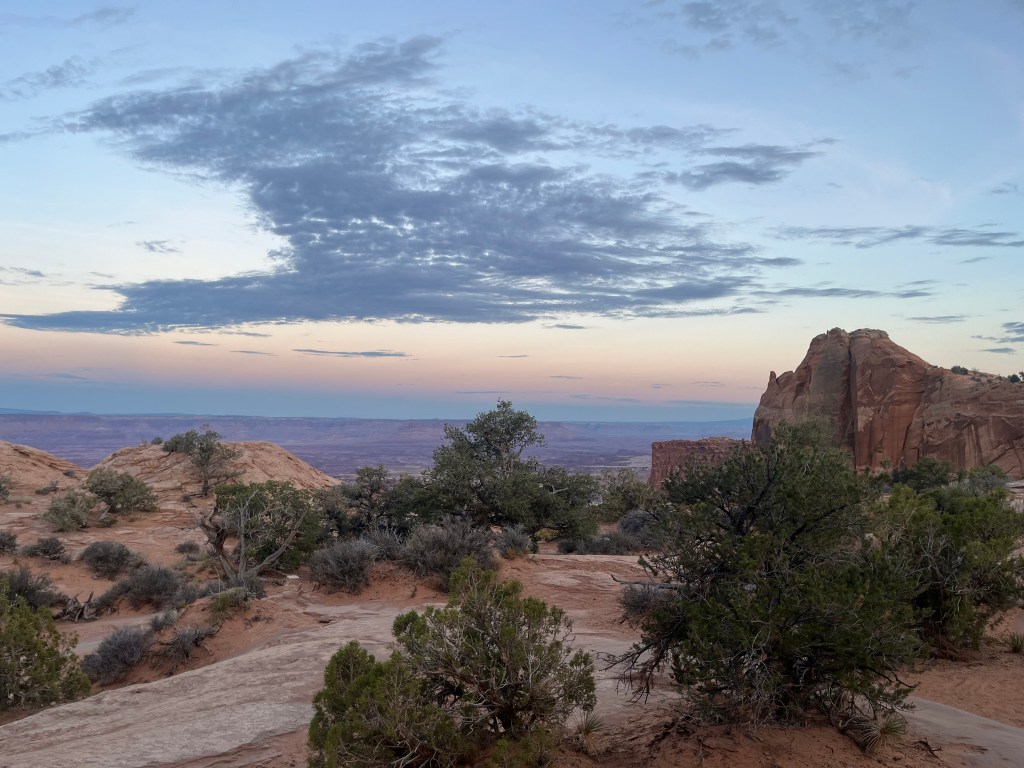
After driving and hiking the park all day, we went back to the hotel and took a nap because we planned to come back at dusk to see the sunset and view the stars in that amazing park. We selected a location a short hike from the parking lot, and sat listening to music watching the day turn to dusk and the dusk turn to night.
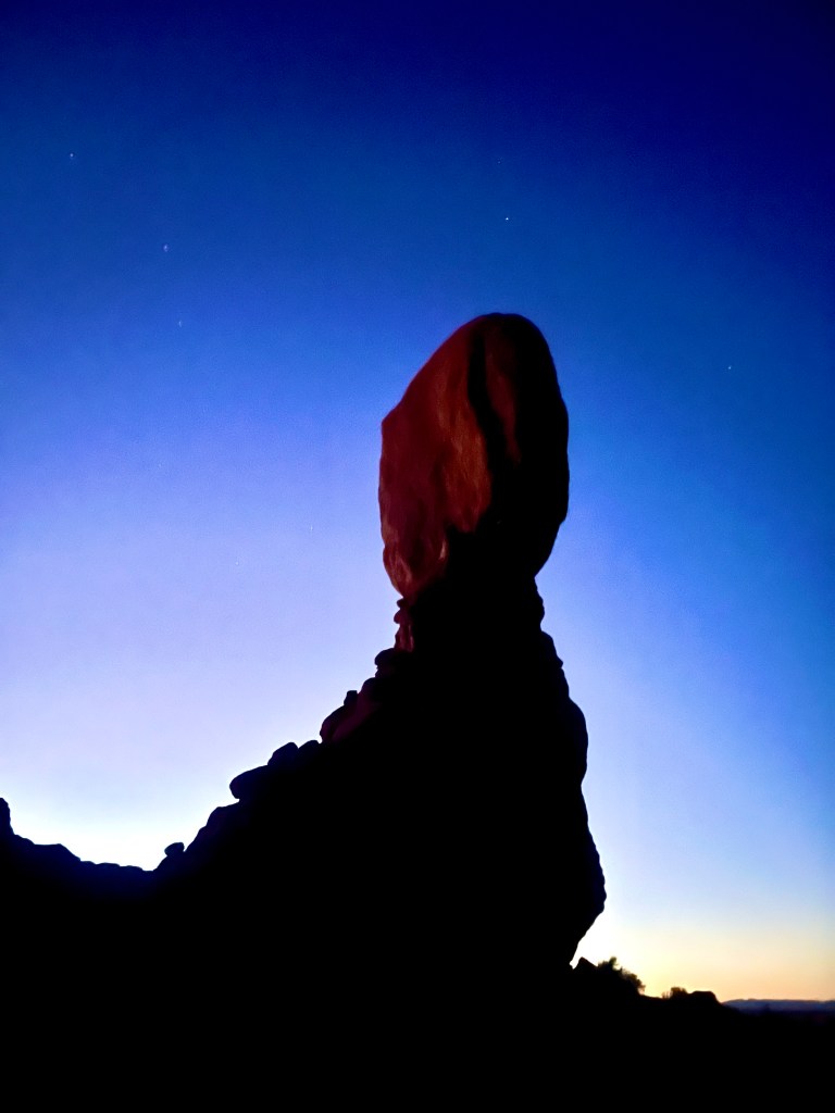

Watching the day slide away was very spiritual in this spot. Those rocks catching the end of the sunlight left them slightly lit alone while all around was dark. As the sunlight came to darkness, something that occurred around 10:15pm the night sky lit up. We saw many shooting stars, lots of satellites, and were able to pick our both constellations and the North Star. Because we were just off the road and not at the top of the mountain, car lights disturbed our view from time to time as the came down the hill and their lights reflected off the rocks around us. We had another night of star gazing planned so we made sure to research and find a darker spot for the next day. Even so, it was absolutely epic to be there lay on the flat rock radiating heat, and take in the Milky Way and the millions of visible stars both with and without binoculars. It was very much a spiritual experience.
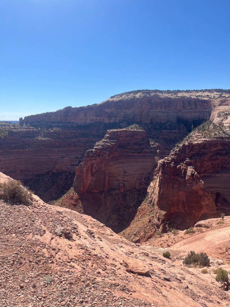
The next day, we explored the Canyonland National Park and Dead Horse State Park, both of which are rated among “The darkest places” in North America.
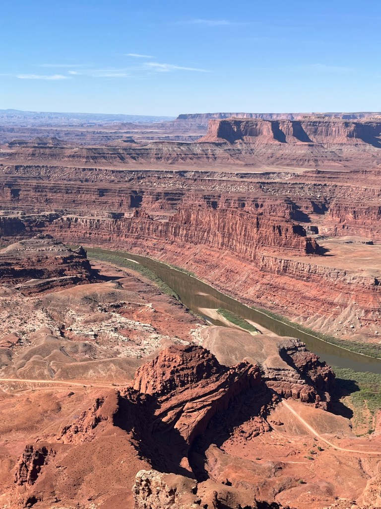
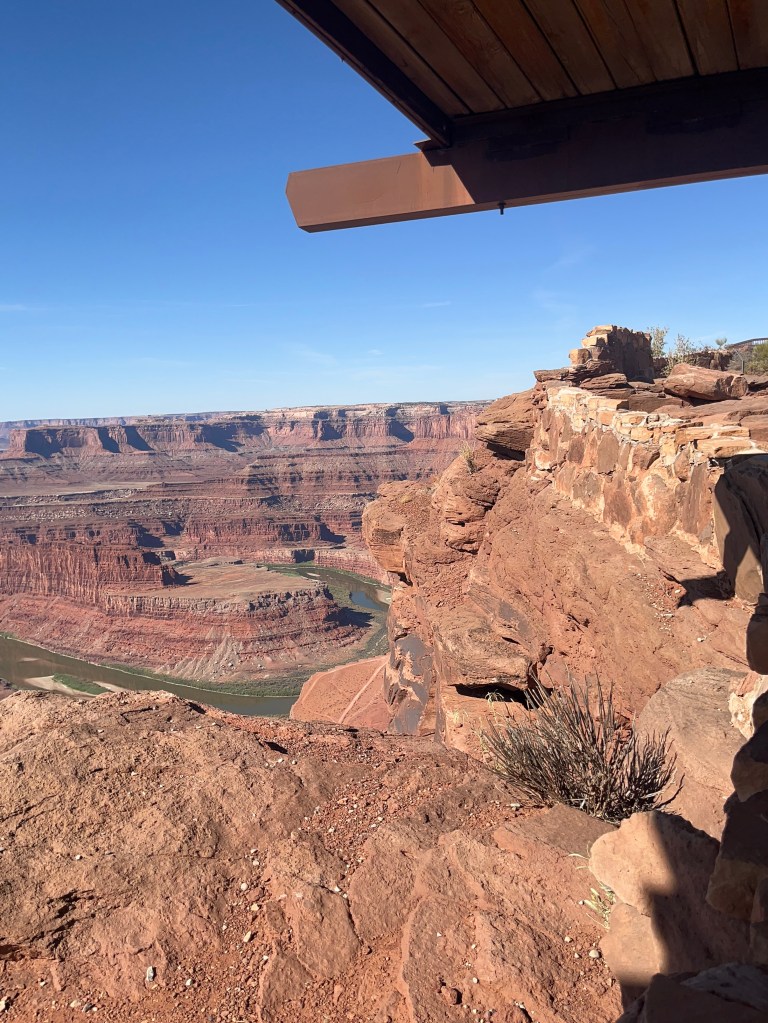
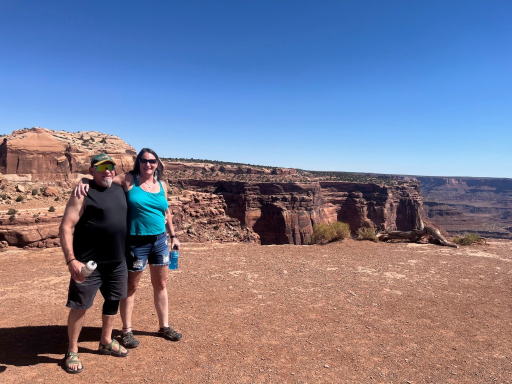
Our first stop was Dead Horse Point State Park, a peninsula of rock atop sheer sandstone cliffs. The peninsula is connected to the mesa by a narrow strip of land called the neck. There are many stories about how this high promontory of land received its name.
According to one legend, around the turn of the century, the point was used as a corral for wild mustangs roaming the mesa top. Cowboys rounded up these horses, herded them across the narrow neck of land and onto the point. The neck, which is only 30-yards-wide, was then fenced off with branches and brush. This created a natural corral surrounded by precipitous cliffs straight down on all sides, affording no escape. Cowboys then chose the horses they wanted and let the culls or broomtails go free. One time, for some unknown reason, horses were left corralled on the waterless point where they died of thirst within view of the Colorado River, 2,000 feet below.
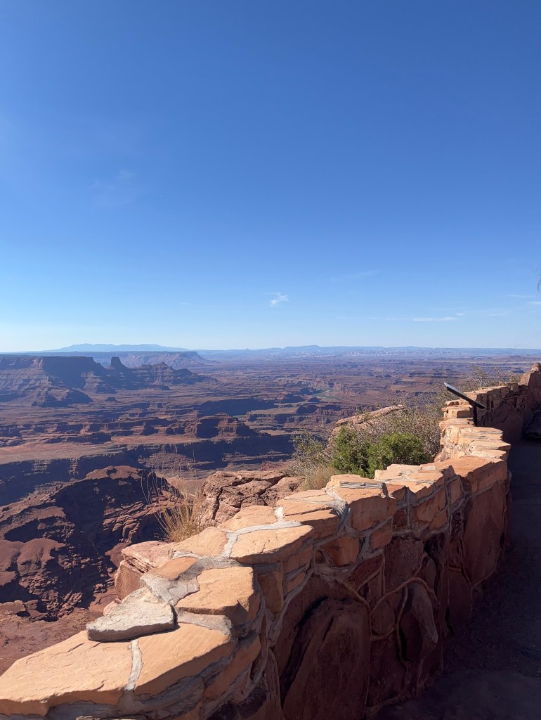
Millions of years of geologic activity created the spectacular views from Dead Horse Point State Park. Deposition of sediments by ancient oceans, freshwater lakes, streams, and wind-blown sand dunes created the rock layers of canyon country. Igneous activity formed the high mountains that rise like cool blue islands out of the hot, dry desert.
The plants and animals of Dead Horse Point have adapted to a land of scarce water and extreme temperatures. Plants grow very slowly here. Trees 15 feet tall may be hundreds of years old. The leaves of most plants are small and some have a waxy coating to reduce evaporation. Most desert animals are nocturnal, active only during cooler evenings and mornings. Some have large ears to dissipate heat, while others metabolize water from food.
While it was clearly not as well appointed or maintained as the Arches National Park, it was still quite beautiful and quite a bit smaller. One thing is that if you remember the movie Thelma and Louise, that iconic last scene was filmed here.


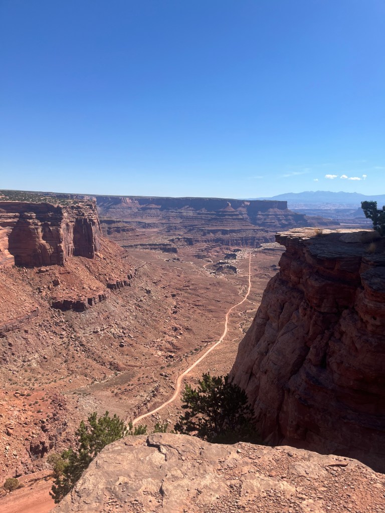
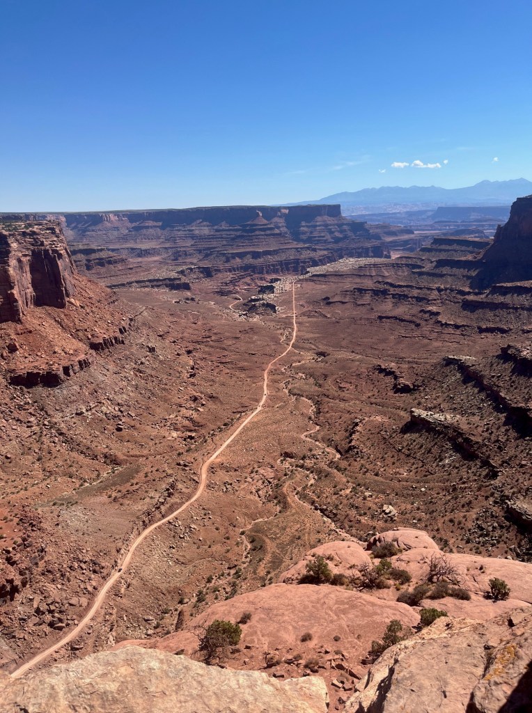
Next we came to Canyonlands National Park. Canyonlands preserves a wilderness of rock at the heart of the Colorado Plateau. Together, water and gravity this land’s prime architects, cut flat layers of sedimentary rock into hundreds of canyons, mesas, buttes, fines, arches, and spines. At center stage are two canyons carved by the Colorado and Green rivers. Surrounding the rivers are vast, very different regions. The Maze to the west, Island in the Sky to the north and and Needles to the east. They share primitive spirit and a Wild West atmosphere. Few people knew these remote lands and rivers well when the national park was established in 1964. Only Native Americans, cowboys, river explorers, and uranium prospectors had dared to enter this rigged corner of southeastern Utah. Canyonlands remains untrammeled – it’s roads mostly unpaved, trails primitive, and rivers free-flowing. Bighorn sheep, coyotes, and other native animals roam its 527 square miles. Canyonlands is wild America.
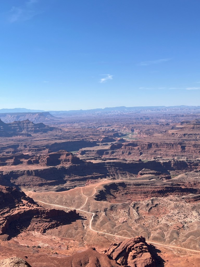
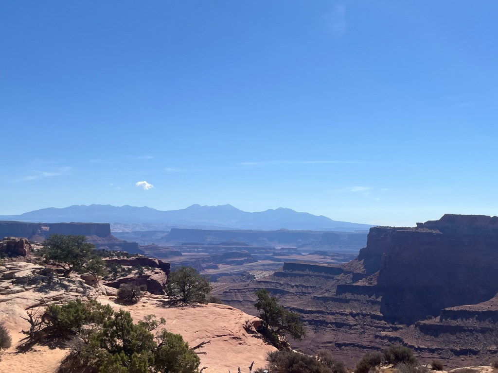
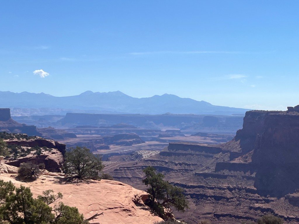
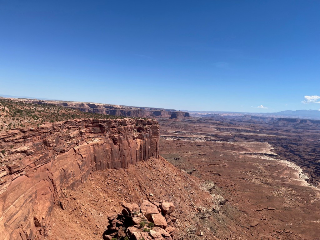
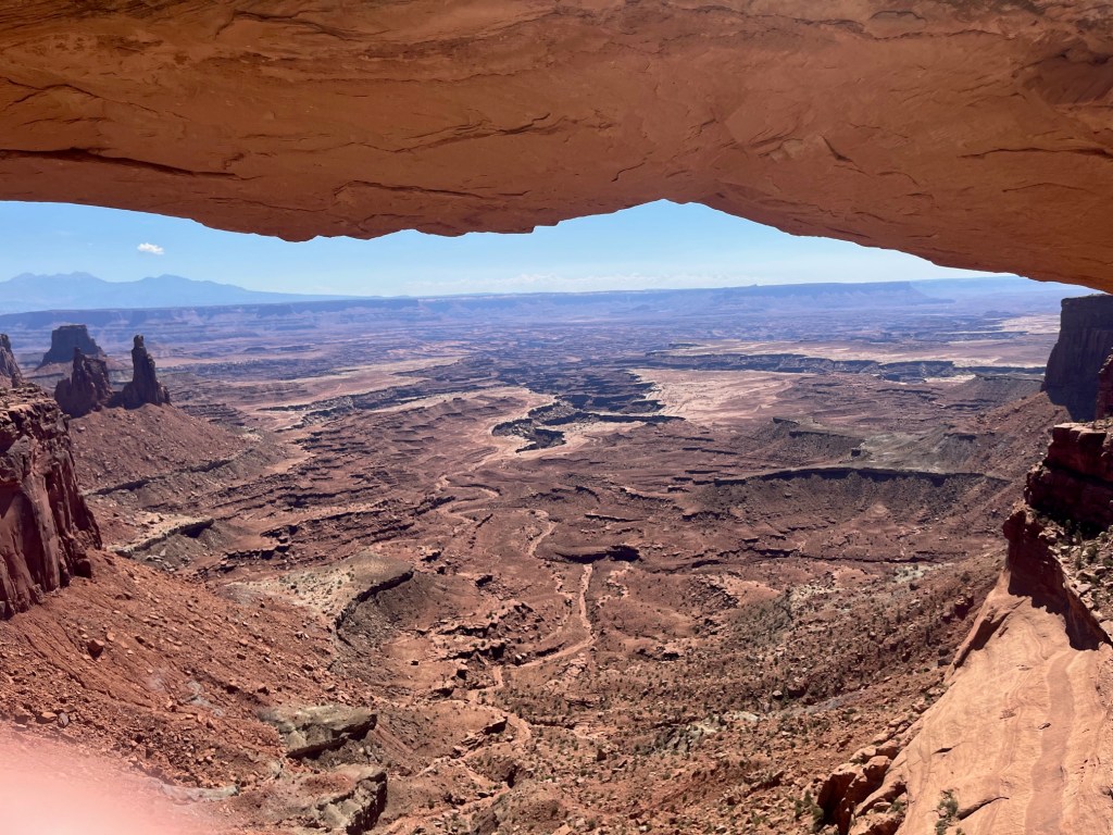
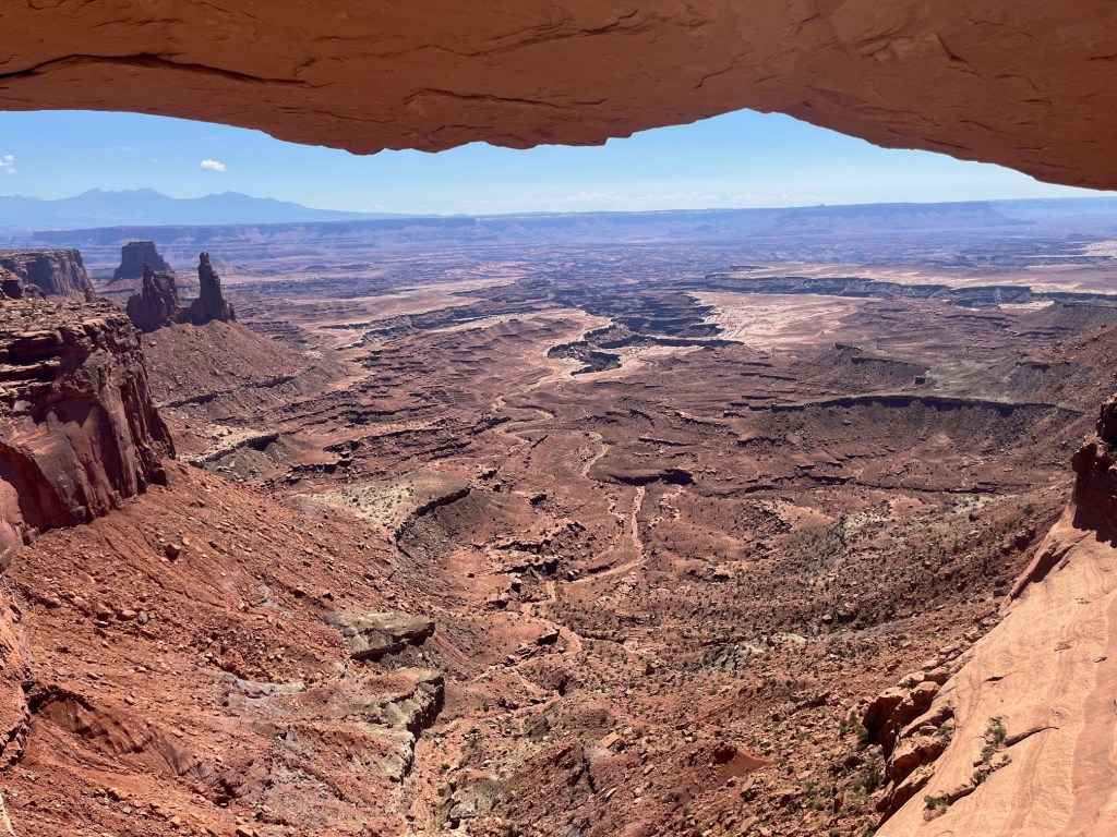
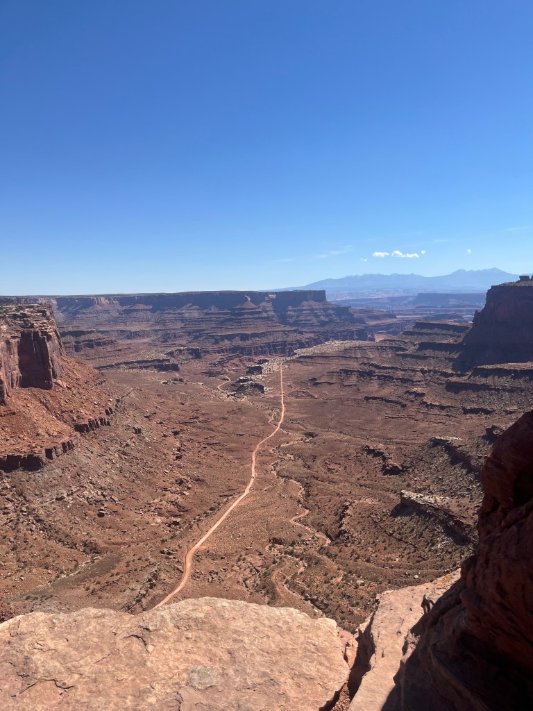
We explored the northern area, Islands in the Sky, to find both great views, and a location to view the Milky Way in total darkness. Because of the canyons, the three areas are not really connected by road, so it would require several days to see the whole park. Views from Island in the Sky reach from the depths of the green and Colorado rivers to the mountain tops and above, across canyon after canyon the views stretch more than 100 miles distant. Island in the Sky — a broad Mesa wedged between the rivers — is Canyonlands observation tower. From it you can see vistas of dimensions hard to comprehend. Closest to the Mesa’s edge is the White Rim, a nearly continuous sandstone bench 1.200 feet below the island. Another 1,000 feet beneath the White Rim ar the rivers overshadowed by sheer canyon cliffs. Beyond them lie the Maze and the Needles.
Outside the park, three mountain ranges break the land’s flat topped pattern. To the east rise the La Sals, the south the Abajos, to the southwest the Henry’s. Rain that skips Canyonlands’ and the soil keep these mountains mantled in forest of pine and fir. At Island in the Sky vegetation is more sparse. Fields of Indian rice-grass and other grasses and pinyon and juniper forests survive on fewer than 10 inches of rain a year. Coyotes, squirrels, along with ravens, hawks and smaller birds share the food of these lands. Cattle and horses once grazed here, abandoned water troughs and fences recall those bygone days.
Rocky ledges leading down to and below White Rim are favored habitats for the desert bighorn sheep. From the Island, they look like tan, fly sized specks only visible to those with the best eyes. We could not spot any, and we had binoculars. It may have been the time of day, but still.
We primarily came to search out a good spot to see the Milky Way, and we chose the spot at the Mesa Arch to return to later in the day. In the meantime, the views are generally amazing.

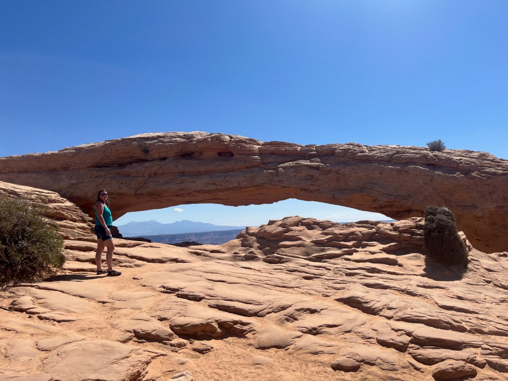

Dusk was approaching as we drove up the steep roads between rock walls on our way up to the Mesa. As we crested the climb, the sun began to dip below the horizon behind low clouds spreading a bright yellow set of streaks and orange fire surrounding the clouds as the disc of the sun began to slide out of sight. The late evening light, yellow and bright illuminated the Mesa as the slalom-like road snaked toward our objective at 6,000 feet. We arrived at the Mesa Arch site to find a few lonely cars in the lot. We unpacked our gear and hiked the short hike to the view spot we had selected earlier in the day.
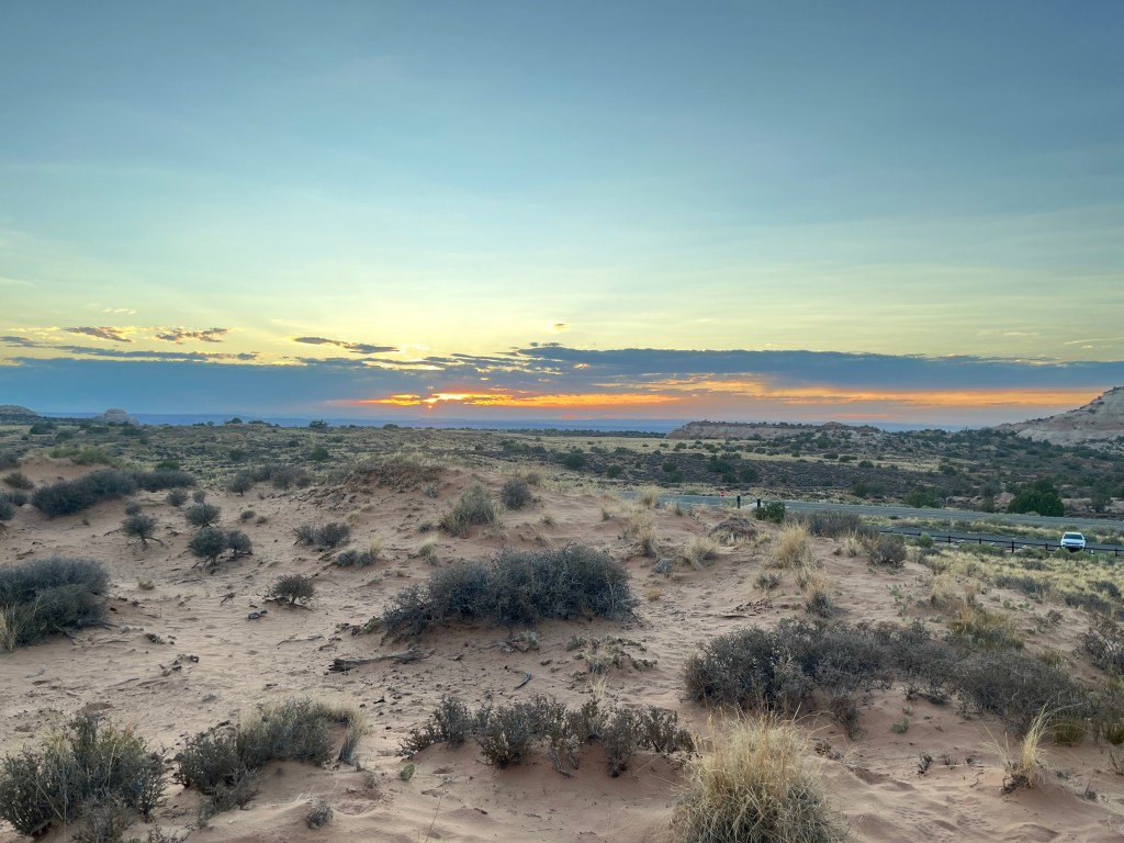
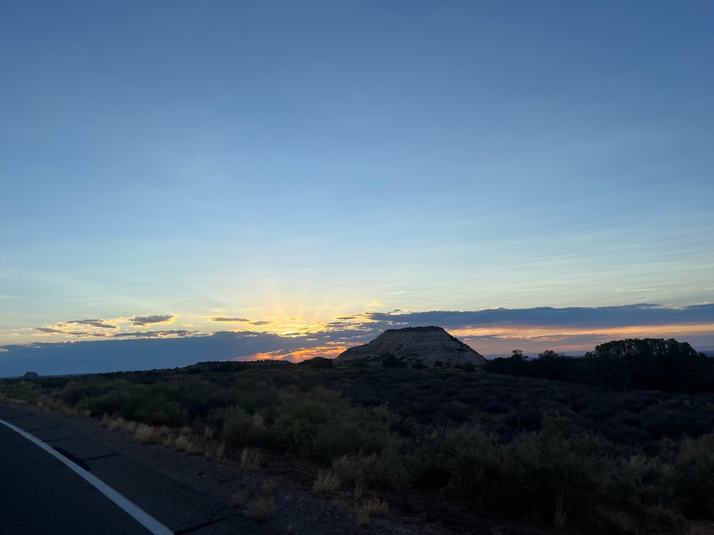
We had selected a large rock below the level of the road, which blocked the late day sunlight. The rock itself was sloped, facing east, with room for us to both sit, or, if we preferred, to lie down to give us full view of the sky. The spot we selected is known as one of the darkest spots in America. A lone cloud on the edge of the front spread across the sky overhead. The last rays of the sun both illuminating the edge of the cloud and causing it to evaporate before the darkness of the night set in.
We listened to Pink Floyd as the dusk became night, watching the scenery change and taking note of each visitor to this sacred spot leaving one by one till we were there alone in the wilderness under a big sky growing gradually darker. You realize how massive the earth and sun are when you contemplate that we are rotating eastward at around 700 miles and hour, and it took more than 2 hours for the last rays of the sun, bending toward earth, finally could not offer any light to us even though we were on a 6,000 ft Mesa. We were lucky too. The dark of night found us under a waning moon that had set early, offering only 6% illumination, making the crystal clear night even darker the stars more visible. LIttle by little, the stars began to break through the darkening sky until the sky was filled with stars, the Milky Way spread across the sky directly overhead. We brought binoculars with us which gave us access to the dimmest stars so far away that the light was barely visible. The sky was filled with stars, dimmer than the planets which were quite bright by comparison. There were numerous satellites visible making their way across the sky, and an occasional shooting star entertaining us while we waited for full darkness.
Full darkness in the darkest spot in the country (No scattered light from nearby towns) came at around 10:15 pm, at which point the sky pops with starlight. We took in the view, commenting to each other in tones of wonder.
Our mission of being in the darkest of places in the country to see the night sky and the Milky Way accomplished, we lay side by side, holding hands taking in the millions of stars overhead in a state of wonder.
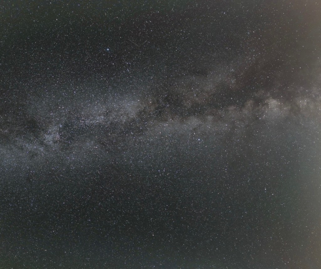
This image does not do the majesty of the night sky justice, but it does reflect the sky as we saw it. We gathered our things and carefully made our way back to our car a little surprised at just how dark it was. As we came over the rise behind us, the Big Dipper and the North Star popped into our view. We stood there for a moment seeing the Western sky for the first time this evening, now with the sun set. Another million stars. We drove home, also carefully in the pitch black of night with no sense of the rock walls around us.
We crawled into bed, and fell asleep with a real sense of accomplishment, the major point of our adventure accomplished in perfect style.
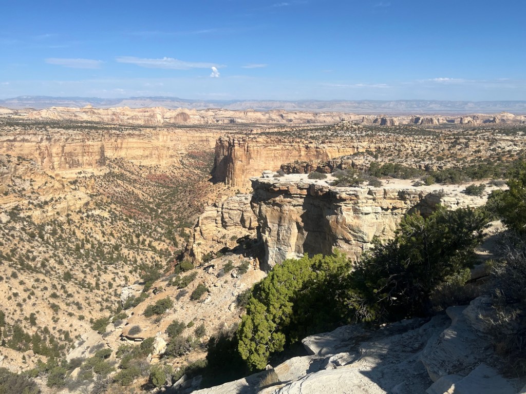
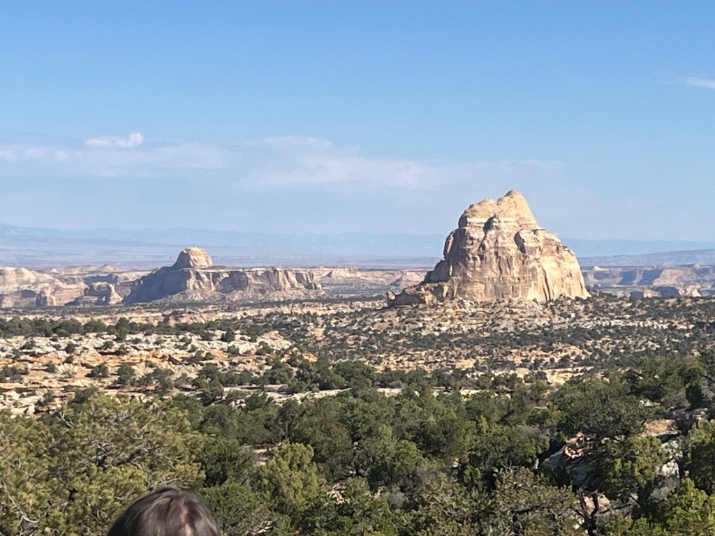
The next day, we took off for the northbound leg of our journey to get home. First stop, Vegas. Our first stop on the road took us to the Badlands, where outlaws like Jesse James and Billy the Kid used to hide out. We learned that these canyons were filled with Uranium so much so that even Madam Curie came to investigate along with prospectors. Otherwise these lands were largely unexplored.
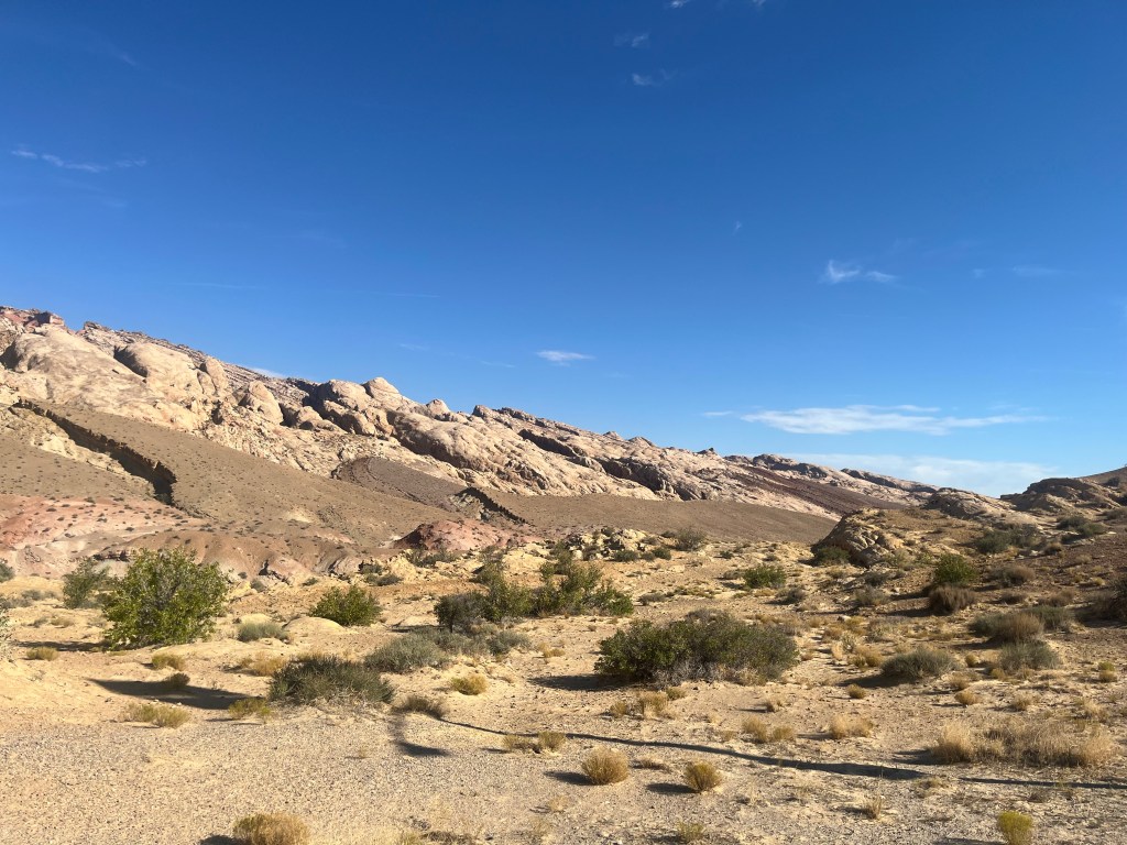


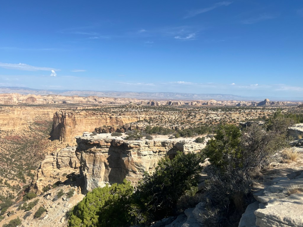
This rugged and desolate land must have been very difficult to navigate, least of which is because in order to cross it, you would have needed to bring water enough to last your whole journey it’s that dry. Hard to see in the images are the myriad of canyons making even a 1 mile journey an all day affair. Talk about the “wild wild west”, well this is it.

At these rest stops, Native women spread their wares out on blankets for passers by to purchase. We wondered about the wisdom of doing so since there were so few cars on the road. It’s also hot as hell in the sun, which had us scratching our heads a bit.
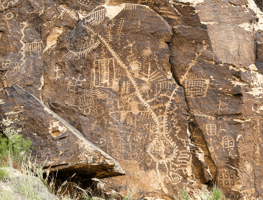
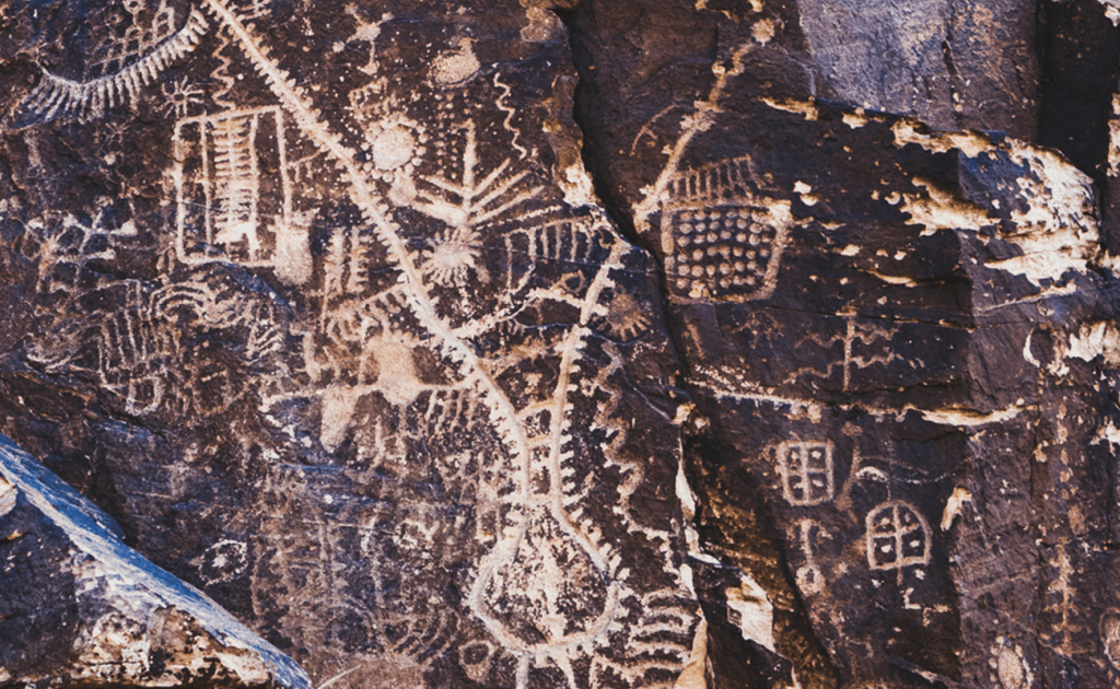
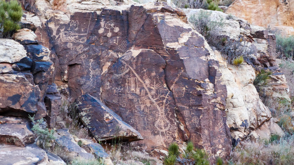
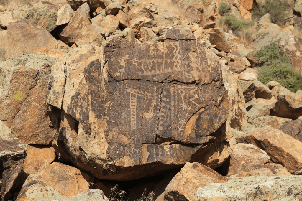
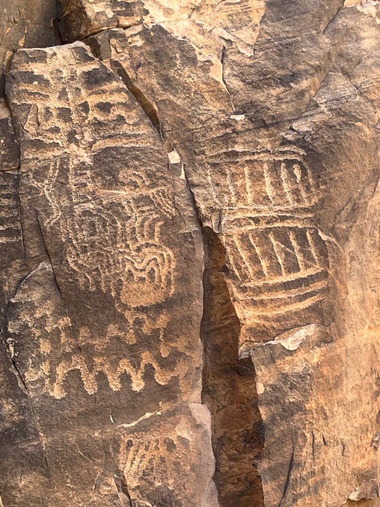
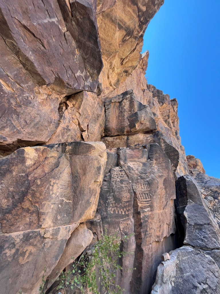
On the road to Vegas, we came to Cedar CIty where in the gap between two hills, was an amazing petroglyph site. Just north of Cedar City, the Parowan Gap Petroglyphs are a spectacular and accessible site with one of the most impressive concentrations of ancient rock carvings in the American West.
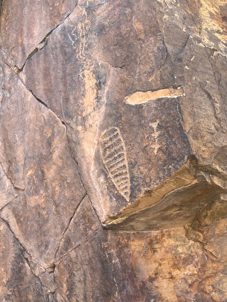
Over 90 carved panels featuring 1,500+ petroglyphs etched into the Navajo sandstone, representing animals, abstract shapes, people, spirals, and geometric designs
Most carvings date to the Fremont culture, created between 700 and 1,500 years ago, though the area had been inhabited for much longer.
The site is sacred to the Southern Paiute and Hopi peoples, and even today many of the glyphs are interpreted through tribal stories. It was very moving to be standing there where perhaps a thousand years ago, someone carved a message for their tribe into the rock, and not just to stand there, but to see the actual carving left behind.

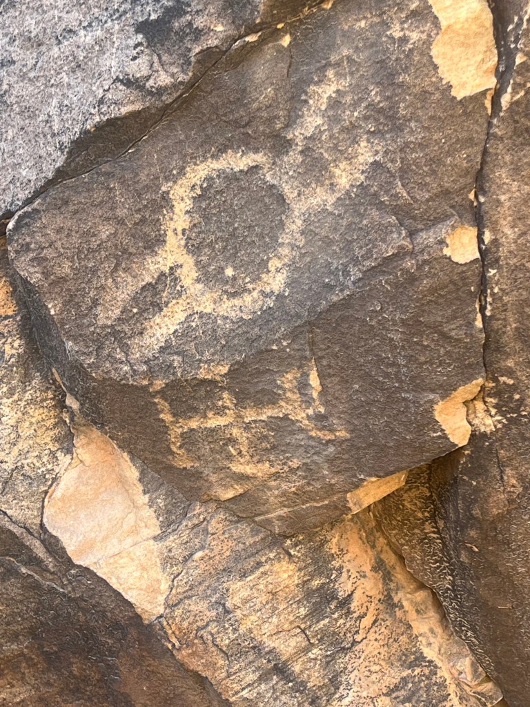
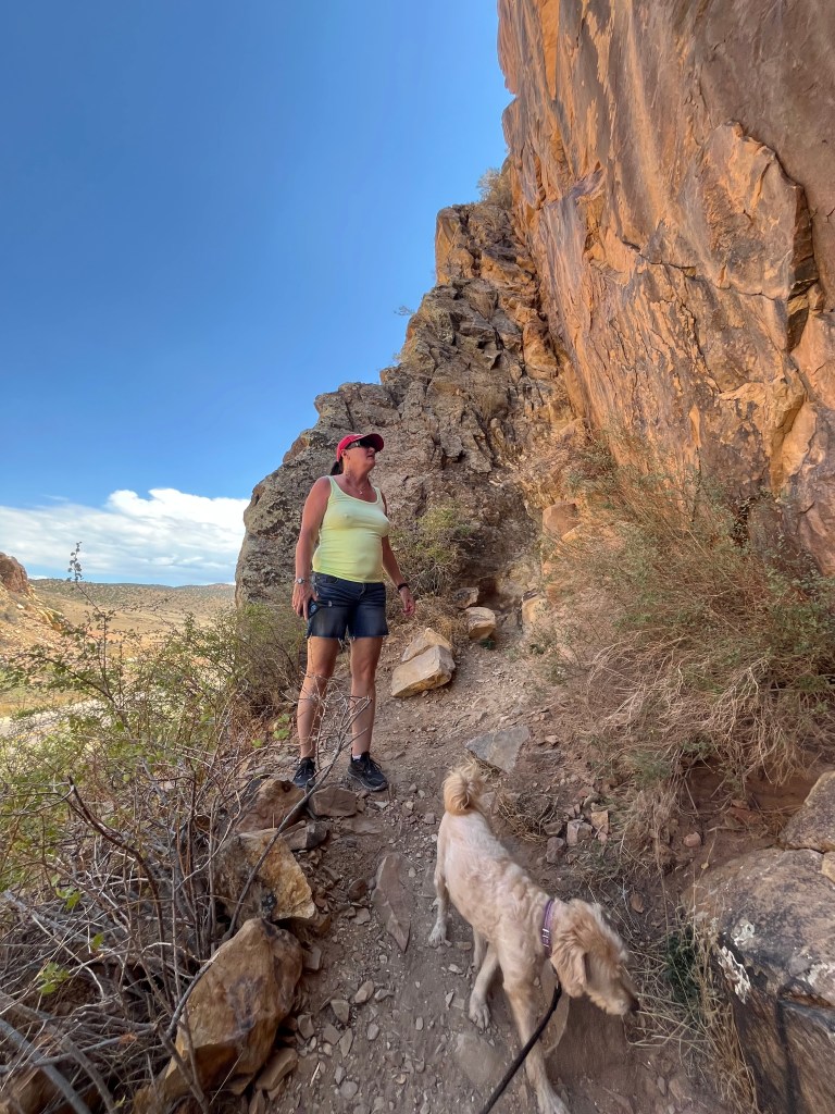
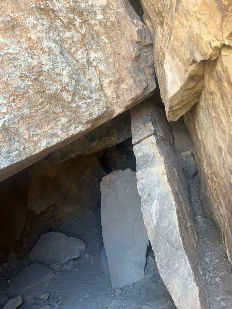
It was really hot out there, perhaps over 100 degrees, but we spied a cave and poked our head in as far as allowed given it was fenced off, and wow, it as at least 30 degrees cooler in the cave!
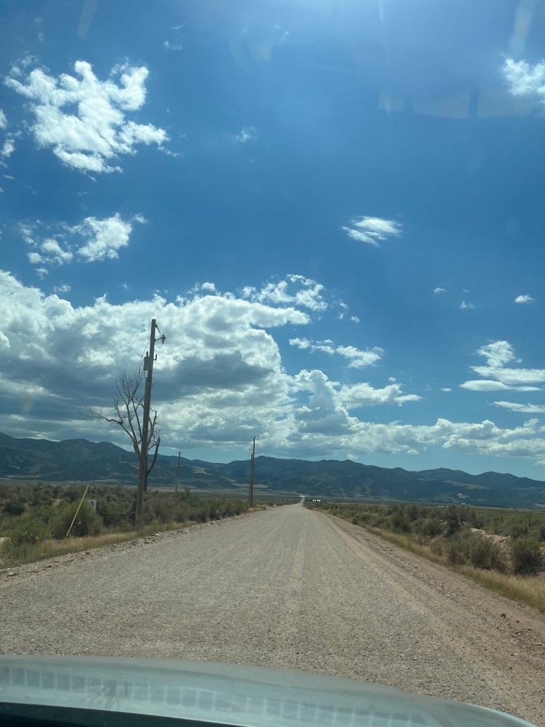
Back on the road, this time a gravel road to get back to the highway, we were alone between fields of onions and a big sky with gathering clouds.
The drive from Vegas to Reno was largely across a desert that was so little traveled, that we had to have a refueling plan to make sure we were able to get back to civilization. We passed Area 51, and watched as the Air Force launched a drone to monitor the area. Again, we were driving on roads with few to no cars at all. We spotted Burros and Mustangs along the way, but mostly just lots of nothing. Hours would go by before we saw a vehicle traveling the same way as us, although several times there were caravans of mostly trucks heading the other way. Eventually we came to a little town where the major attraction was the Clown Motel. I kid you not.
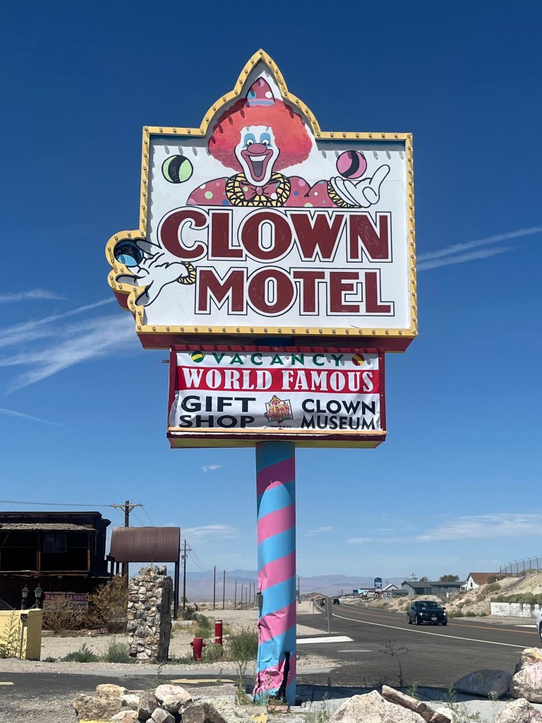
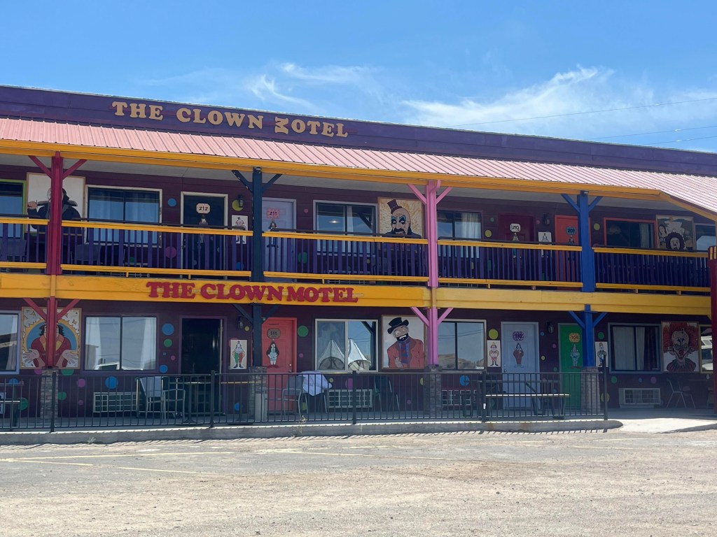
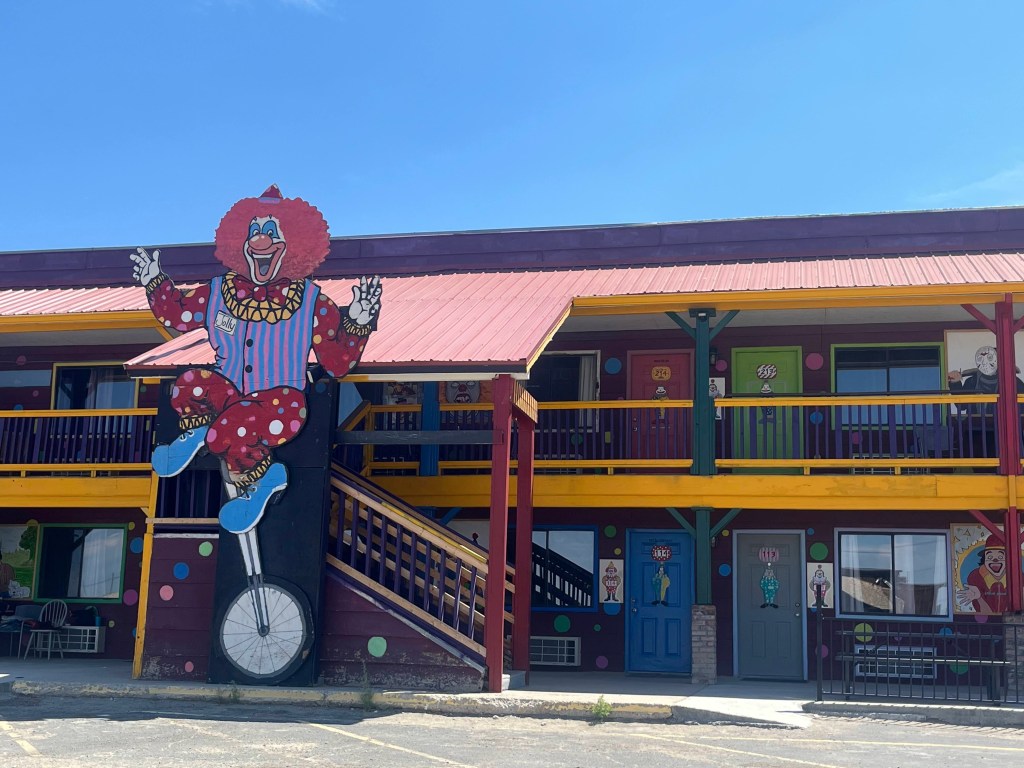
Needless to say, we did NOT stay over!
On into Reno, we discovered that there are tons of wild mustangs wandering around. We stayed in a shithole motel in Reno having pre-booked at a Ramada inn. I strongly suggest you give it a pass. Then off we went to California on our way to Ashland.
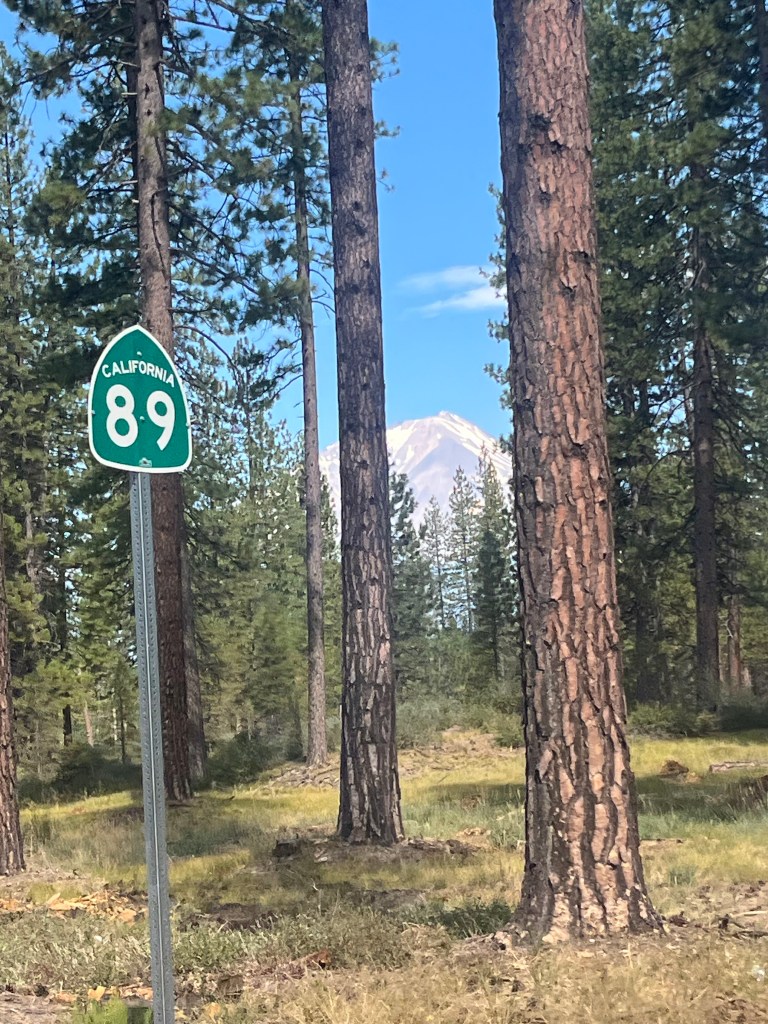
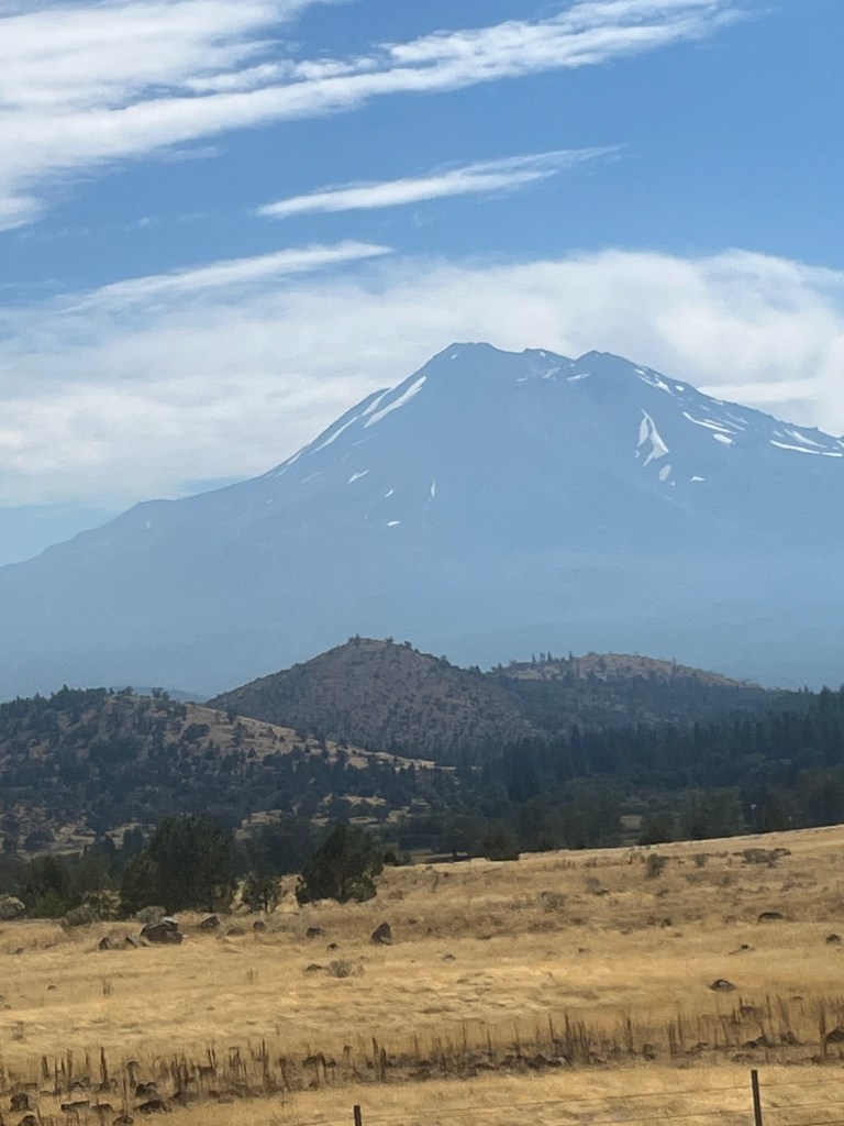
We stopped at a truck stop for a hearty breakfast, and then it was off through the National Forests to Ashland. It was so great suddenly driving through actual woodlands after being in the dessert for a week, Those Ponderosa Pines are so distinct. We were driving through in an area in the back country that had zero cell coverage, so we could not even listen to the Arsenal game that day. (Arsenal beat Leeds 5-0 so it made the rewatch pleasurable once we got home!) The highlight of the trip was to see Mt Shasta in all it’s glory.

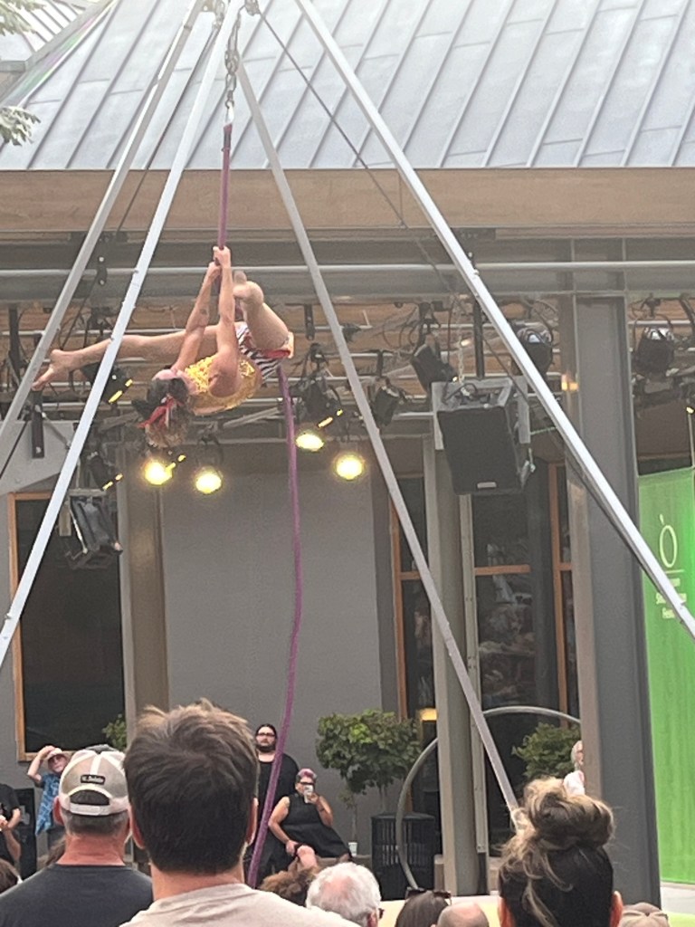
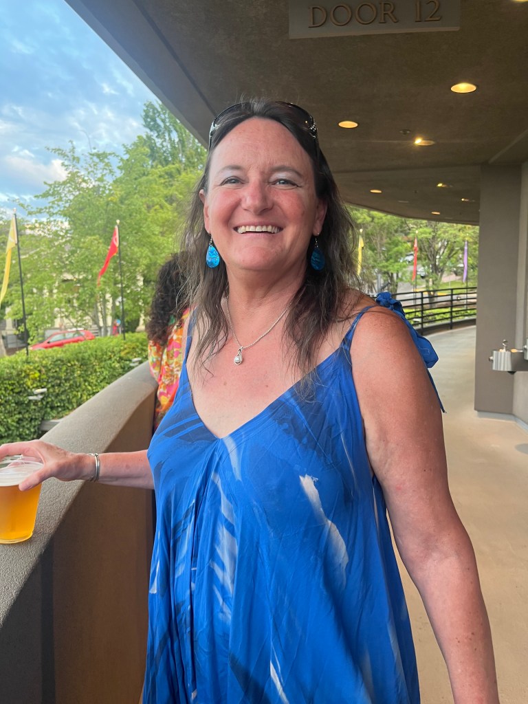
Coming in to the Northwest as we transitioned from Northern California into Oregon, you can literally feel the temperature drop. It was still hot and sunny, but MUCH much cooler. We arrived in Ashland and thankfully, had a much nicer place to stay. We indulged in some late afternoon fish tacos at a spot and had a cold beer, well deserved after a long drive. The highlight of our stay in Ashland was having an opportunity to enjoy the Shakespeare Festival in the outdoor theater.
Before we were allowed admittance, a trapeze or rope artist entertained us.
Heather was looking lovely in her bright blue gown which amplified her eyes.
When we got into the theater, it was both intimate and breathtakingly beautiful.
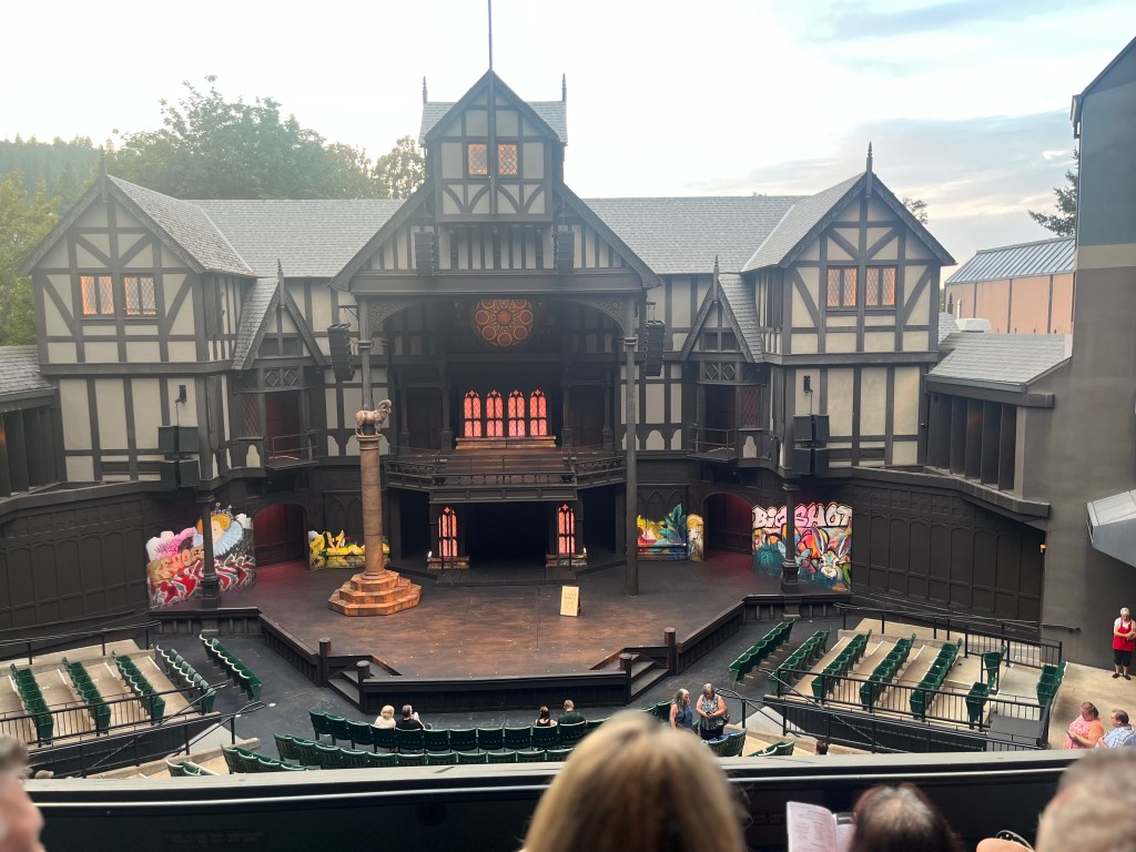
We waited for the sky to darken and for the theater to fill enjoying reading about the play in the program.
As the sky darkened the ambiance really increased in this unique outdoor theater.

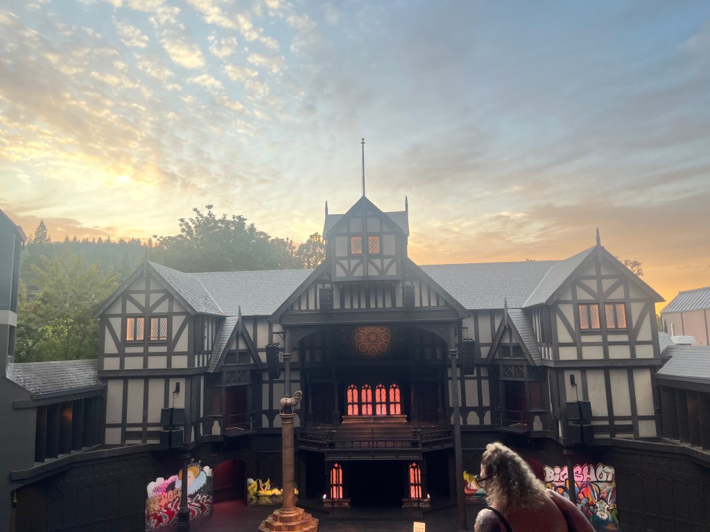
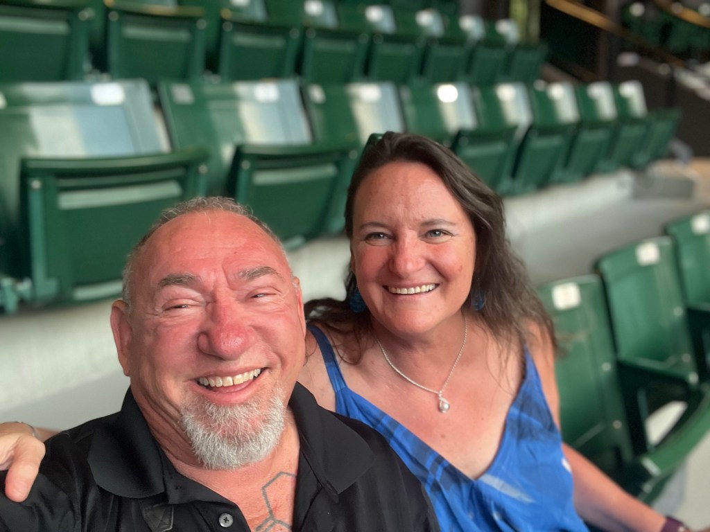
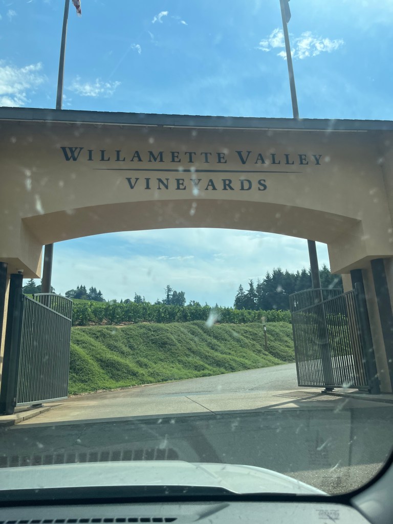
We had a great time and really enjoyed the opportunity to support the arts in this festival that I have been dying to attend for years. In the morning we got back on the road and made our way to Portland where we stopped for a wine tasting at Willamette Valley Vineyards a winery Heather has had on her list for ages.
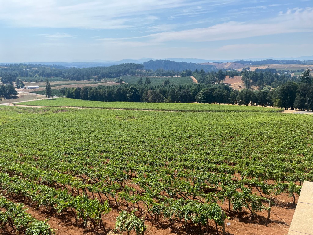
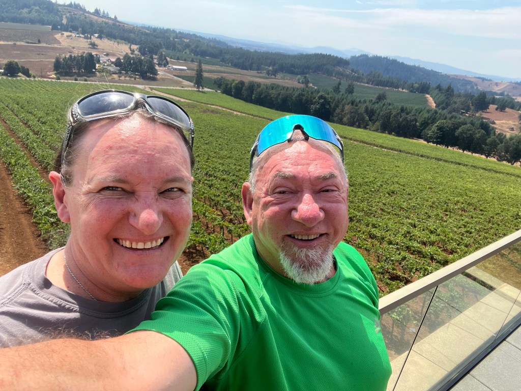
It was quite picturesque after all the nothing we had seen on the road, so it was a welcoime sight looking over the vanguards while sipping on a nice cold glass of wine.
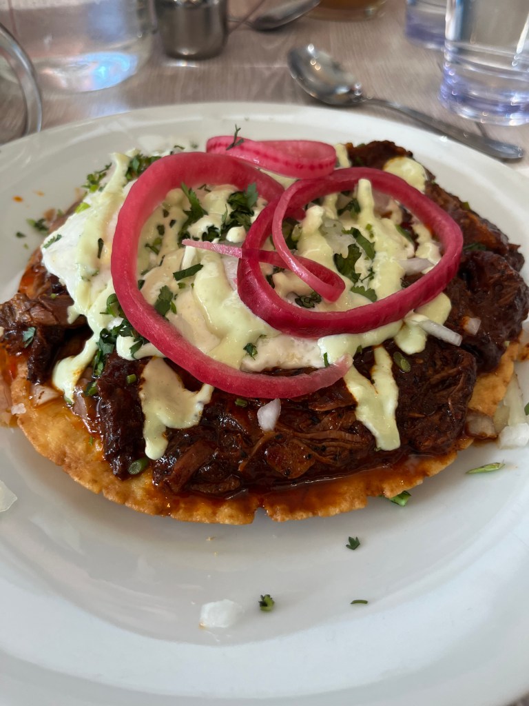
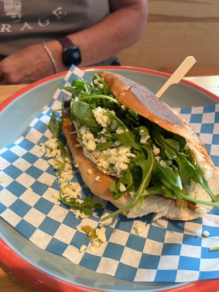
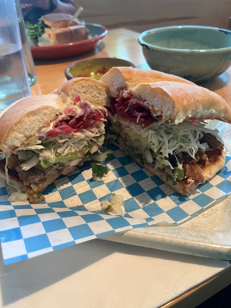
After that, we went up to Portland and chose to stop for a fabulous Torta at Guero’s – Highly recommended.
Then it was a slog driving in Washington State where the only thing keeping us from getting home at a decent hour were the ridiculous traffic jams that we had not seen anywhere else in the West. Aah, we were home.
I’ll say this about our trip. First of all, it was a trip of a lifetime. We got pretty lucky in that we had pretty great weather which made the driving pleasant for the whole trip other than a light rain in Montana the morning of the second day. Traffic throughout the trip was much lighter than I anticipated. I have been in Yellowstone National Park in the past where it has been bumper to bumper traffic all day. This did not happen at all anywhere on our trip. I blame the price of gas and the economy generally. We were a little surprised to learn that the National Parks are open 24 hours a day, which is great for star gazing. We also got lucky stopping at a random paleontology museum that happend to be in the town of Price where we stopped for a bathroom break. What a find. That random stop framed our whole time in South Eastern Utah, giving us real insight into the why’s and wherefores that made the journey even more memorable. In short, we had a blast, covered over 3,000 miles and enjoyed every minute. It gave me an opportunity to see America as it is, instead of the place its become politically. Being with Heather 24/7 for a week was also super fun. We really had a great time exploring together.
